Jaw-dropping bird's-eye-view photos of Canada
Canada from the air

Thanks to its enormous landmass that stretches from the US border to the Arctic Circle, Canada is a country of extraordinary wonder. With coasts bordering three oceans, multiple mountain ranges, dense forests, shining cities and harsh Arctic tundra, every corner of Canada offers its own unique view.
Click through for stunning aerial photos that reveal a new perspective on Canada’s most beautiful sights...
Slims River, Yukon
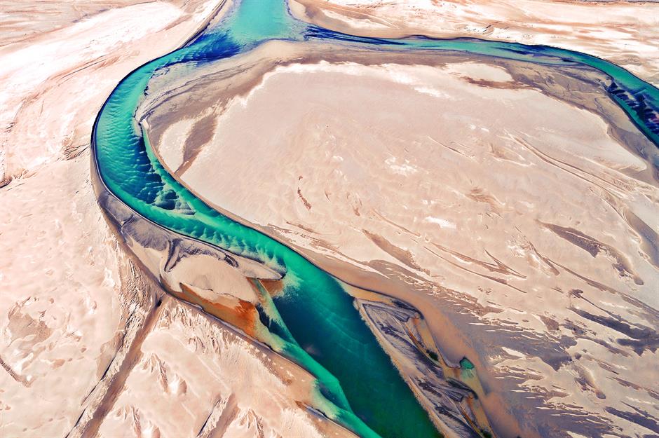
Winding through a pale, silty landscape, the Slims River looks almost surreal from above – but this striking curve tells a deeper story. Once fed by the Kaskawulsh Glacier, the river was abruptly drained in 2016 by a rare case of 'river piracy', when meltwater rerouted to a different valley. What’s left is a beautiful trace of a river reshaped by climate change.
Emerald Lake, Yukon
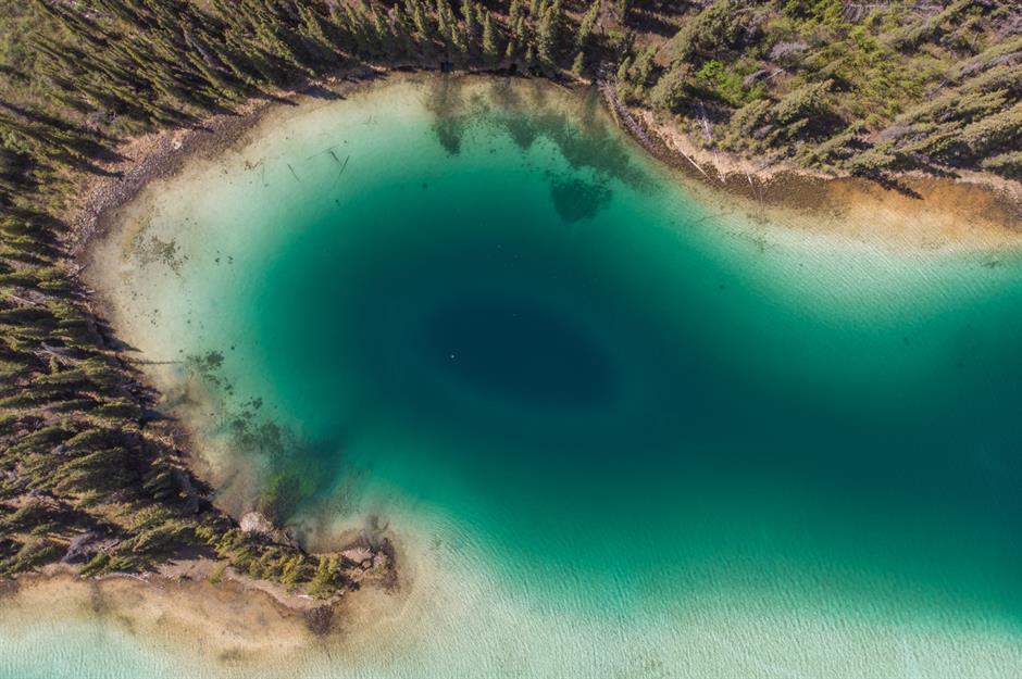
Located near the Alaska/Yukon border, Emerald Lake’s brilliant green colour comes from the sun reflecting off deposits of marl, clay and calcium, left thousands of years ago by ancient glaciers. Surrounded by trees and mountains as far as the eye can see, the lake is a gorgeous representation of Canada’s vast northern wilderness.
Sponsored Content
Miles Canyon, Yukon
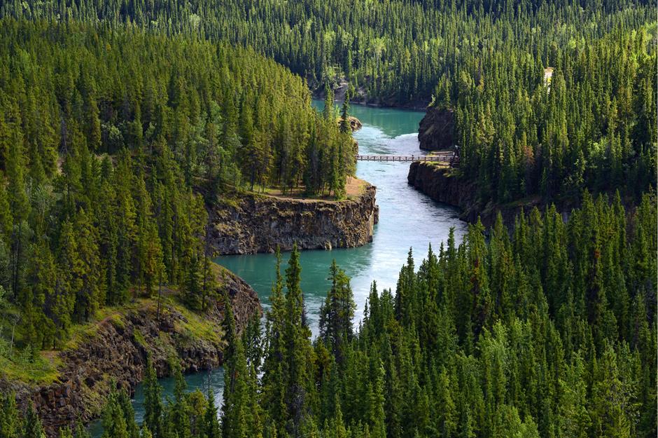
Created by a pre-glacial lava spread, Miles Canyon is one of the most beautiful spots along the Yukon River, thanks to its cool, clear, turquoise waters. The canyon is quite close to the city of Whitehorse and was part of a major historic thoroughfare during the Gold Rush.
Chesterman Beach, Tofino, British Columbia
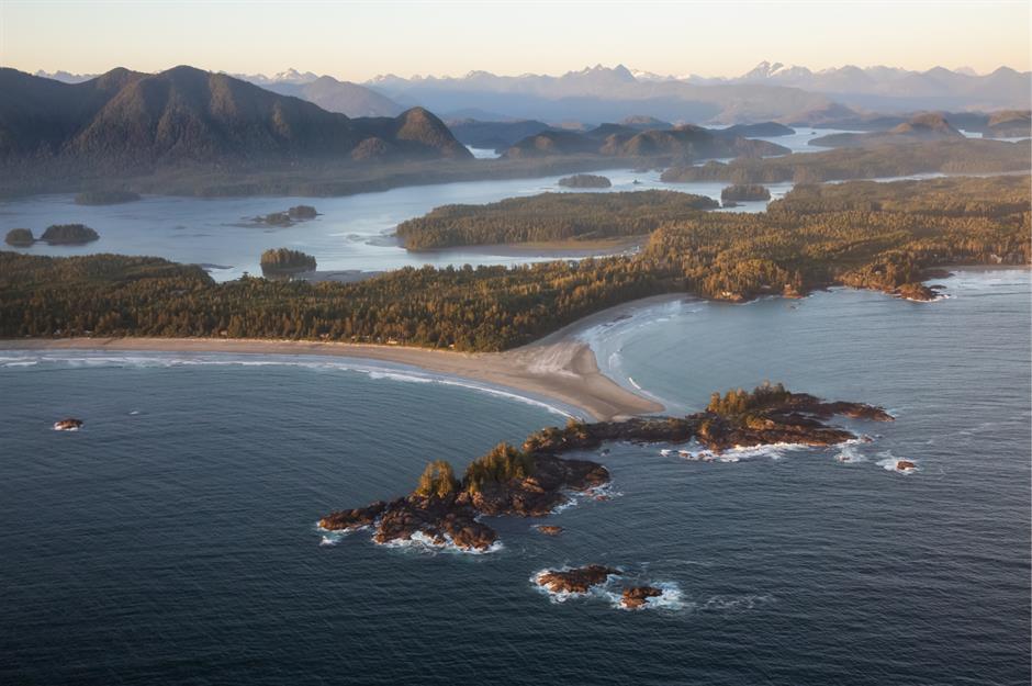
The community of Tofino, which sits on the west coast of Vancouver Island, is famous for its wild waves, attracting both surfers and storm-watchers. Chesterman is one of the most popular beaches in the area because of its long stretches of sand and proximity to the luxurious Wickaninnish Inn.
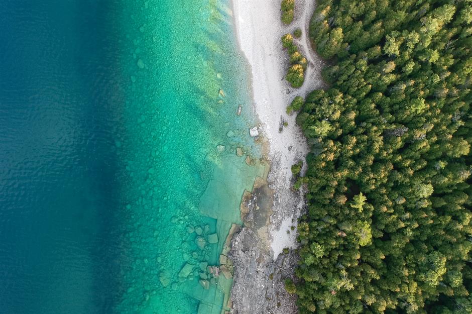
Brooks Peninsula Provincial Park, British Columbia
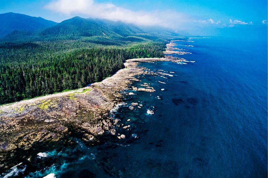
Brooks Peninsula Provincial Park can be found in the northwest corner of Vancouver Island, which is much quieter and less populated than the island’s southern half.
The nine-mile (14km) ocean peninsula offers a view of the Pacific at its most rugged, with a rich ecosystem featuring plant life that is completely unique to the area.
Sponsored Content
Haida Gwaii, British Columbia
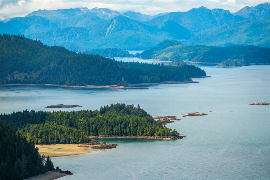
Often referred to as 'the edge of the world', Haida Gwaii is one of Canada’s most extraordinary slices of coastal wilderness. The chain of islands is home to the Haida people, making it as rich with Indigenous culture and history as it is in wildlife and lush sky-scraping trees.
Capilano Suspension Bridge, Vancouver, British Columbia
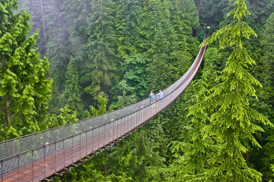
One of Vancouver’s most famed tourist attractions, the Capilano Suspension Bridge is right in North Vancouver, but it feels like it’s in the middle of a remote forest.
Stretching 460 feet (140m) across the Capilano River and countless Douglas fir trees, a suspension bridge has been in this location since 1889. It's since evolved from a simple hemp rope foot bridge into a sturdy wire cable bridge capable of holding many visitors at once.
Fraser River Delta, British Columbia
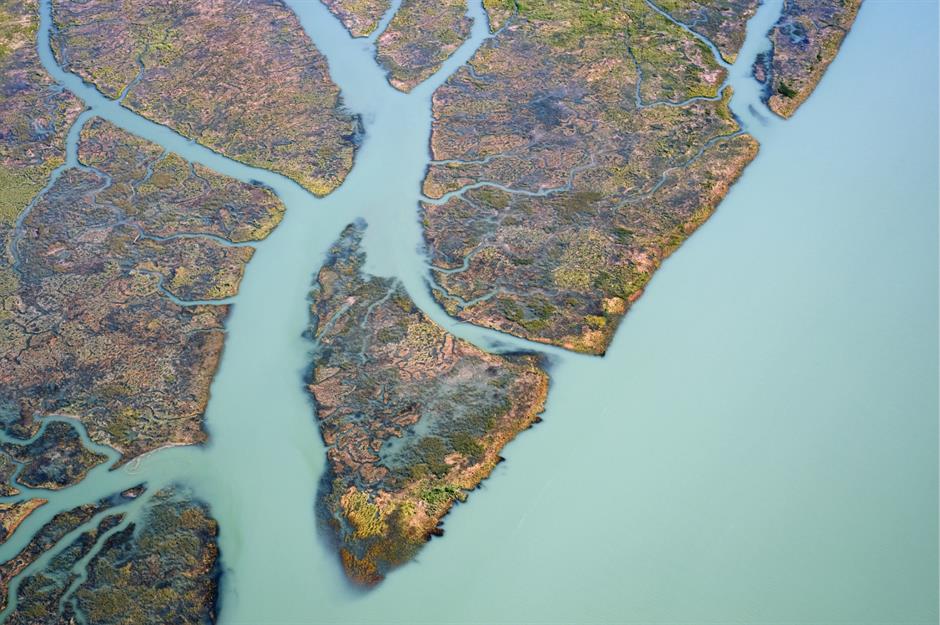
British Columbia’s Fraser River drains from the Coast Mountains into the Strait of Georgia before heading out into the great Pacific Ocean. The soil at the mouth of the delta is rich with silt that’s been washed down from the mountains, making for a distinctive ecosystem at the western edge of Canada’s mainland.
Sponsored Content
Lake Louise, Alberta
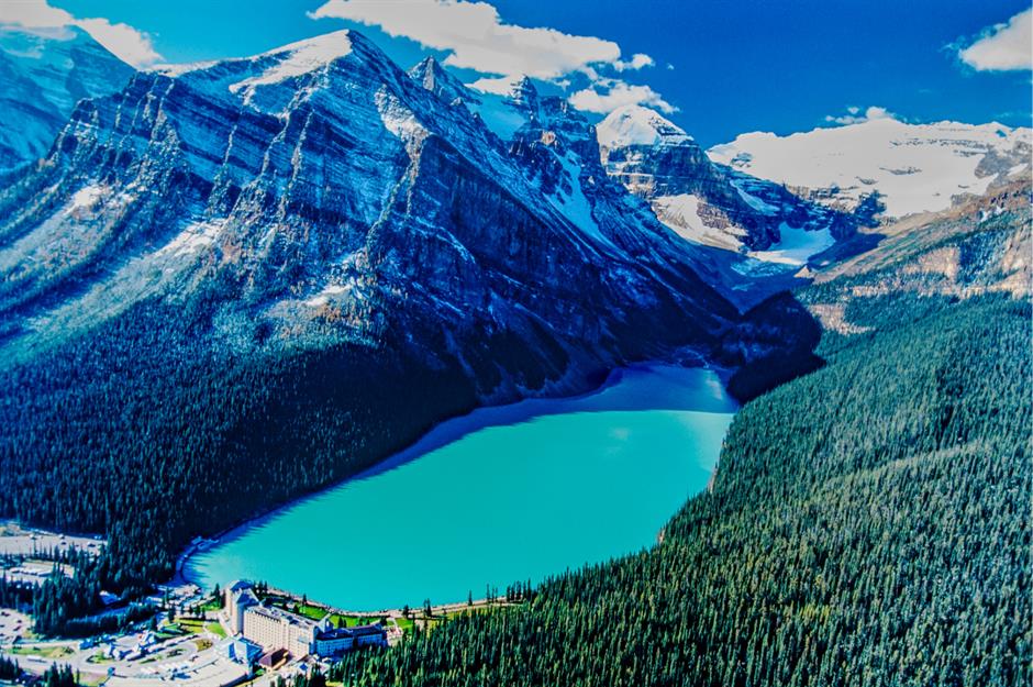
Probably the most famous of Banff National Park’s signature turquoise lakes, Lake Louise is an almost unbelievably perfect glacial lake nestled in a spectacular mountain valley.
Part of the lake’s appeal is its accessibility – the Chateau Lake Louise, a luxury hotel, sits right on its shores and visitors can drive right up to a parking lot a short walk away. The lake is also surrounded by relatively easy hiking trails to provide a better view of the ice-cold waters.
Icefields Parkway, Alberta
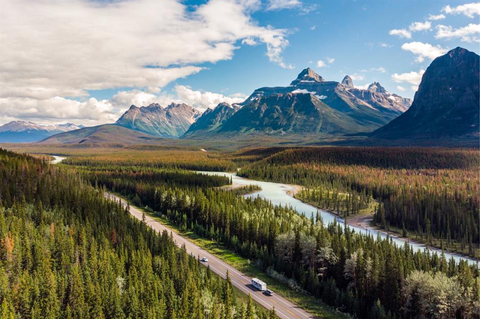
The road that runs between Lake Louise and Jasper offers one of Canada’s most beautiful road trips. The Icefields Parkway is a 144-mile (232km) stretch of roadway that winds along the Continental Divide, just skirting the British Columbia/Alberta border.
Along the way drivers can take in multiple viewpoints, turquoise lakes, wandering wildlife and the majestic Athabasca Glacier.
Peyto Lake, Alberta
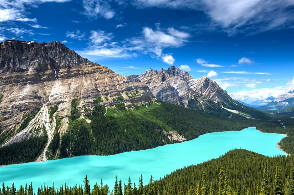
Peyto Lake is another turquoise glacial lake, but this one is almost exclusively seen from above, thanks to an easily-accessed viewpoint just off the Icefields Parkway. The brilliant colour of the water comes from the sun reflecting off rock flour that’s deposited in the lake by glacial runoff.
Sponsored Content
Wood Buffalo National Park, Alberta
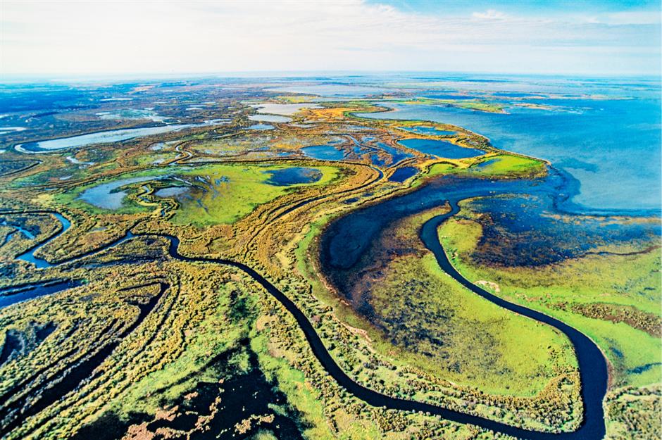
The second largest national park in the world, Wood Buffalo is known for its vast swathes of land, natural springs, karst sinkholes and the Peace-Athabasca Delta, one of the world’s largest fresh water deltas.
All of this makes for a very interesting and often unusual northern landscape, earning the park a coveted UNESCO World Heritage Site designation.
Dinosaur Provincial Park, Alberta
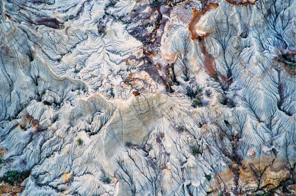
Standing in stark contrast to the cool snow-capped peaks of the Rockies, the rolling hills of Dinosaur Provincial Park look like they belong on another planet. The park is located about two hours east of Calgary and gets its name from the prehistoric fossils entombed within its craggy badlands.
Alexandra Falls, Northwest Territories
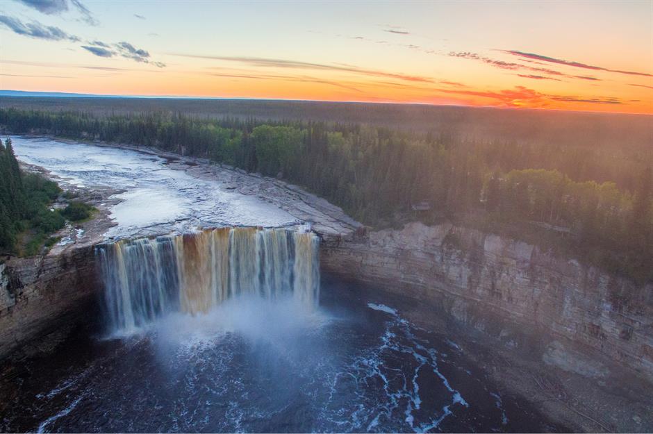
Part of the Hay River, Alexandra Falls is one of the Northwest Territories’ most dramatic water attractions. It’s part of Twin Falls Gorge Territorial Park – the other half of the 'twins' is Louise Falls, which is located just a short hike away.
At 105 feet (32m), Alexandra is only the third highest waterfall in the Northwest Territories, but its width and volume make it a sought-after sight.
Sponsored Content
South Nahanni River, Northwest Territories
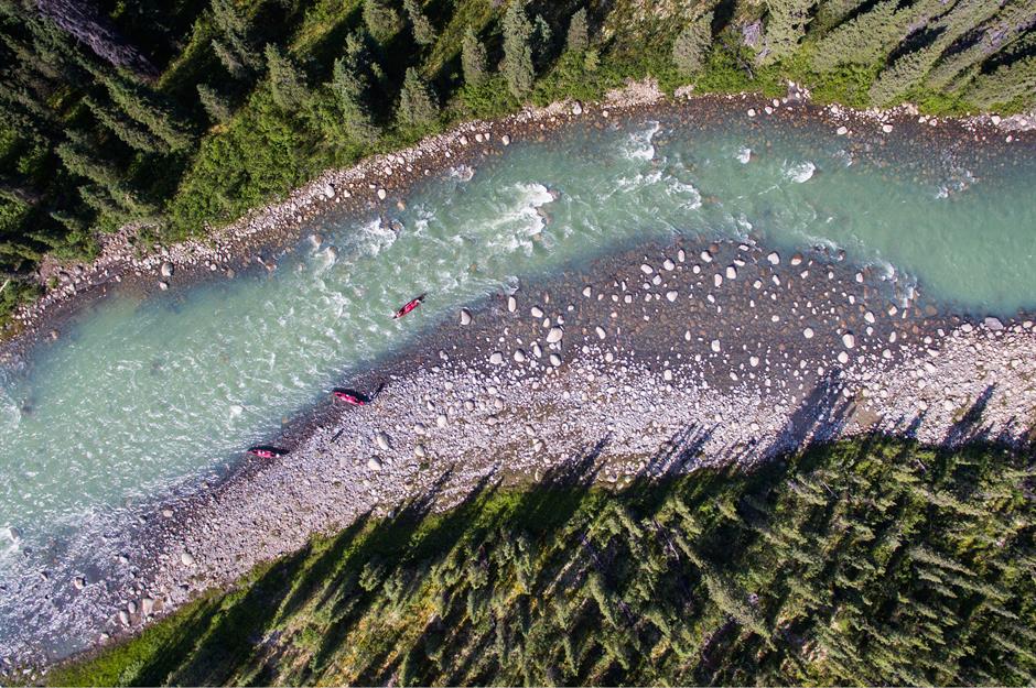
Surrounded by deep forests, jagged mountains and dramatic canyons, the South Nahanni River is a paradise for adventurous paddlers and nature lovers. The river cuts through Nahanni National Park Reserve, a spectacular protected area west of the city of Yellowknife.
Farmers’ fields, Saskatchewan
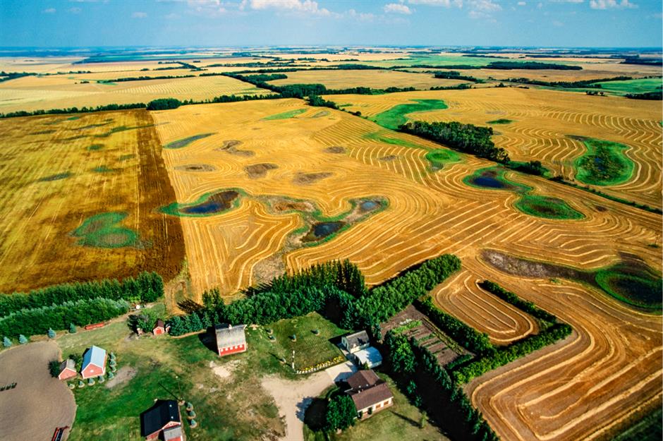
With its sea of flat prairie land as far as the eye can see, Saskatchewan is the breadbasket of Canada. The yellow canola fields are responsible for the province’s signature landscape shots, but Saskatchewan is also a major global producer of other essential crops like lentils, peas, oats and durum wheat.
Bruce Peninsula, Ontario
Jutting into the turquoise waters between Georgian Bay and the great Lake Huron, Bruce Peninsula is home to not one, but two national parks. The peninsula boasts some of the oldest and most awe-inspiring cedar trees in eastern North America as well as a wide variety of wildlife and migratory birds.
Sponsored Content
Toronto, Ontario
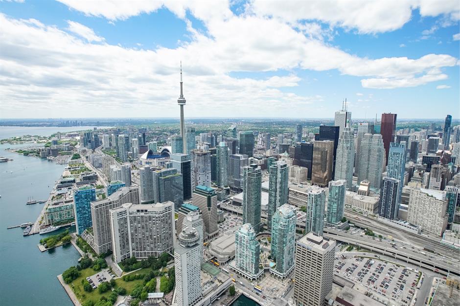
The downtown of Canada’s largest city sits gleaming on the shore of Lake Ontario, a lake so large that it looks like an ocean as one stands on its shores.
As the country’s financial hub, downtown Toronto has more than its fair share of skyscrapers, the most famous of which is the CN Tower. Standing at 1,815 feet (553m), the tower held the title of the world’s tallest free-standing structure from 1976 to 2007.
Niagara Falls, Ontario
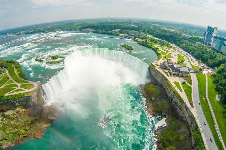
The most famous waterfalls in the world sit right on the US/Canada border, but the Canadian side of the line is by far the best place to see Niagara Falls’ outstanding Horseshoe Falls, even though a slice of Horseshoe technically falls within New York State. In addition to thrilling onlookers, the falls also act as an important source of hydroelectric power.
Algonquin Provincial Park, Ontario
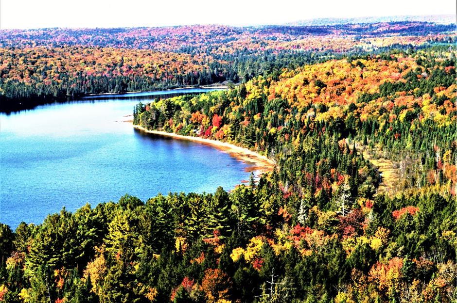
A perfect picture of rugged Canadiana, Algonquin Provincial Park is home to maple trees, wild moose, common loon and waterways ideal for canoeing.
The park is beautiful year-round and usually a major summer vacation destination for city dwellers in Toronto and Ottawa, but it’s particularly stunning in the fall when the seasonal colours are out in full force.
Sponsored Content
Parliament Hill, Ottawa, Ontario
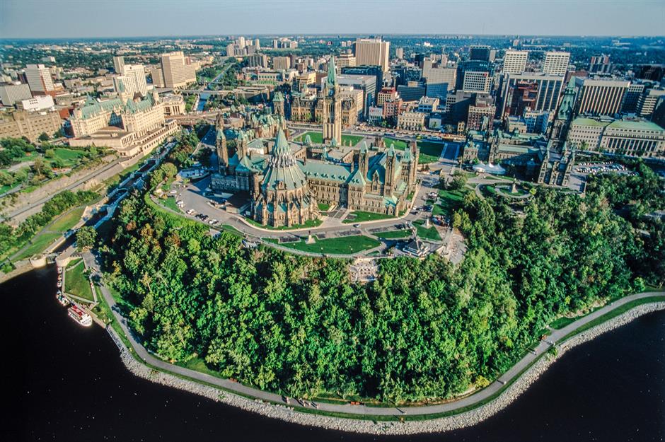
The home of Canada’s government sits on the Ontario side of the Ottawa River, but it’s perhaps best viewed from Gatineau, Québec. The Parliament buildings are a striking example of Gothic Revival architecture, with the Centre Block currently undergoing the largest heritage renovation in Canadian history. Initially expected to finish in 2028, the project is now set to wrap up around 2031, with public reopening in 2032.
Sirmilik National Park, Nunavut
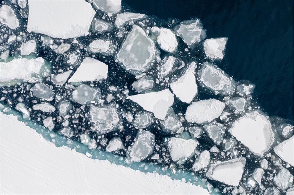
Located on Baffin Island, far north of Canada’s mainland, Sirmilik National Park is a land of ice and frigid ocean water. In Inuktituk, the language spoken by the Inuit people, the park’s name means 'land of glaciers', a fitting title considering how much of the area is covered by frozen ice caps.
Montréal, Québec
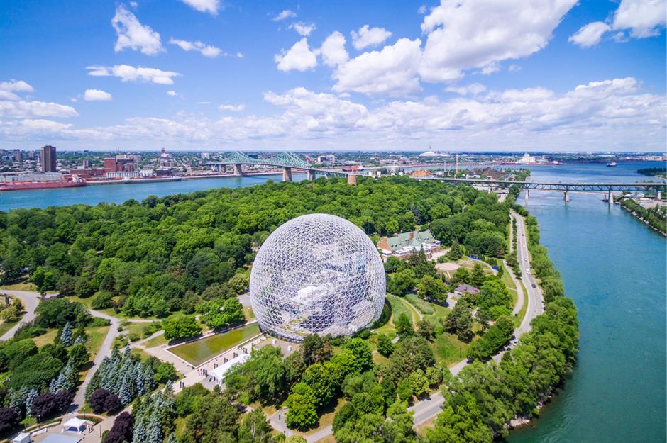
Montréal is Québec’s largest city and one of the most beautiful and culturally vibrant metropolitan areas in all of Canada. The Montréal Biosphere, pictured here, at Parc Jean-Drapeau on St. Helen’s Island is housed in the former American pavilion from Expo ’67. It’s now an interactive environmental museum.
Sponsored Content
Percé Rock, Québec
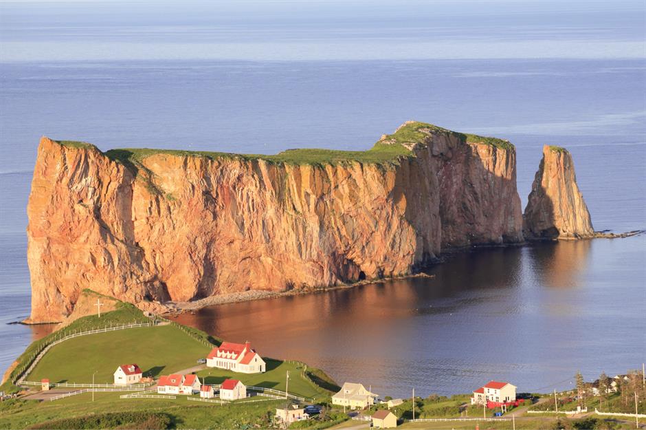
One of Québec’s best-known natural wonders, Percé Rock is a magnificent rock formation off the tip of the Gaspé Peninsula in the Gulf of St. Lawrence. The rock features one of the world’s largest natural arches. Its name translates to 'pierced', referring to the hole under the arch.
Cavendish, Prince Edward Island
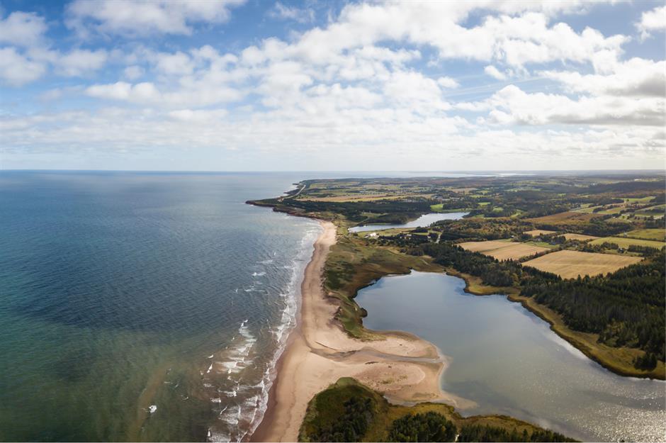
One of Prince Edward Island’s most popular tourist areas, the community of Cavendish is located right in the centre of the north shore of the island.
Cavendish boasts some of Canada’s prettiest beaches and is also the former home of PEI’s most famous writer, L.M. Montgomery, author of the beloved Anne of Green Gables books.
Campobello Island, New Brunswick
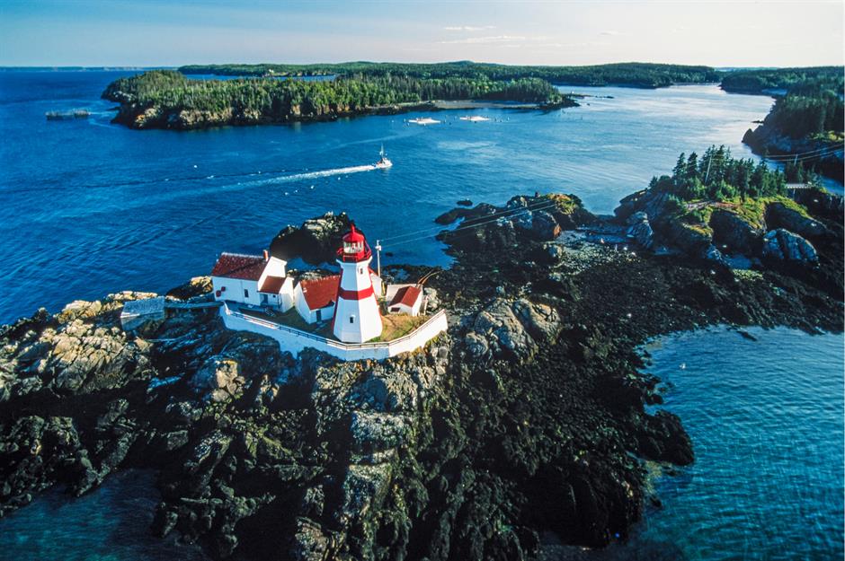
Campobello Island is an inhabited island in the Bay of Fundy near the border of Maine, that typically attracts more American visitors than Canadians.
It’s actually connected to Lubec, Maine via the Franklin Delano Roosevelt Bridge and is only accessible to the rest of New Brunswick via ferry. The island is full of recreational activities and is dotted with charming historic lighthouses.
Sponsored Content
Aspy Bay, Nova Scotia
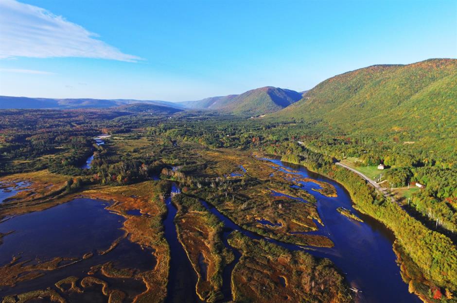
Cape Breton’s Cabot Trail is one of the most scenic drives in all of Canada. Aspy Bay is located just off the Trail on the northern tip of the island, which sits just north of the main part of Nova Scotia.
It’s a rugged spot right on the Atlantic Ocean, but the area is also known for its harbour inlets surrounded by mile upon mile of sandy beaches.
Peggy’s Cove, Nova Scotia
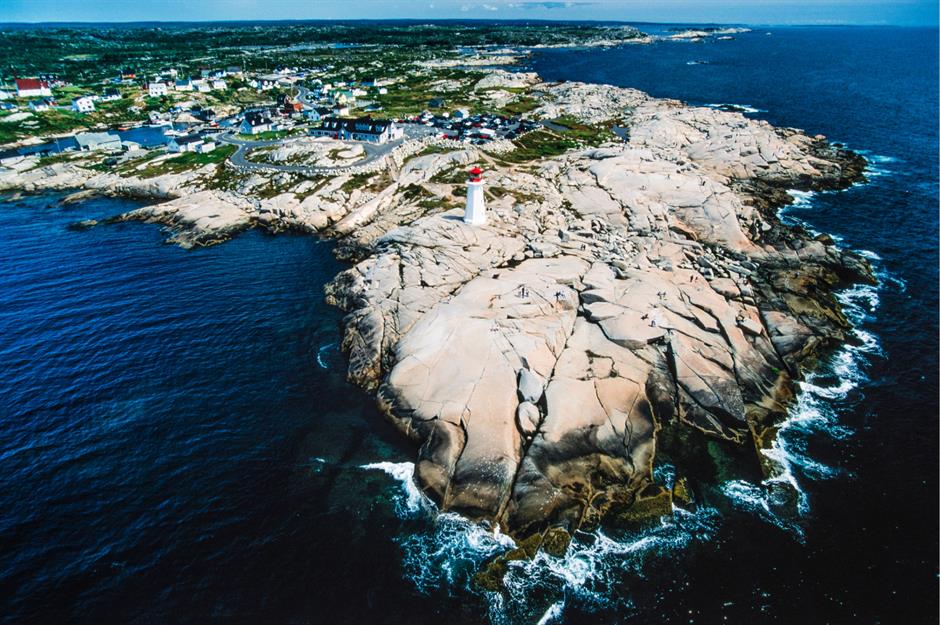
The lighthouse at Peggy’s Cove isn’t the only one in Nova Scotia by any measure, but it is probably the most famous. The seaside town is in Margaret’s Bay on the east coast of Nova Scotia, just south of Halifax.
The quaintness of the community and the drama of the waves hitting the rocks near the lighthouse have made the cove one of the most popular tourist attractions in Atlantic Canada.
St. John’s, Newfoundland and Labrador
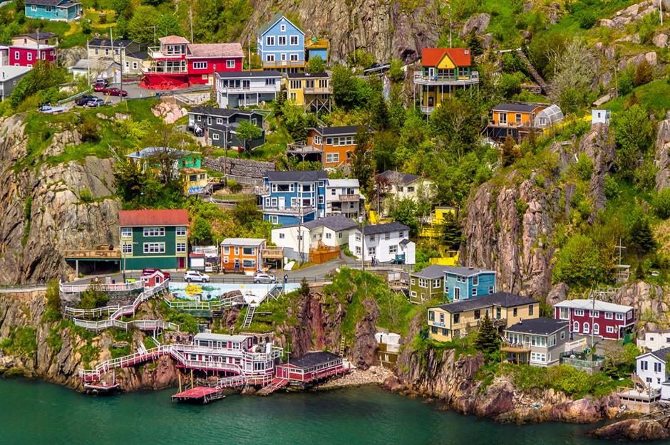
St. John’s, the capital of Newfoundland and Labrador, is a lively city full of culture, which is reflected in the colourful houses that appear throughout the city.
No one is quite sure why the city has adopted bright pink, yellow, blue and green as its unofficial palette, but the houses certainly brighten up the city on a foggy Atlantic day.
Sponsored Content
The Tablelands, Gros Morne National Park, Newfoundland and Labrador
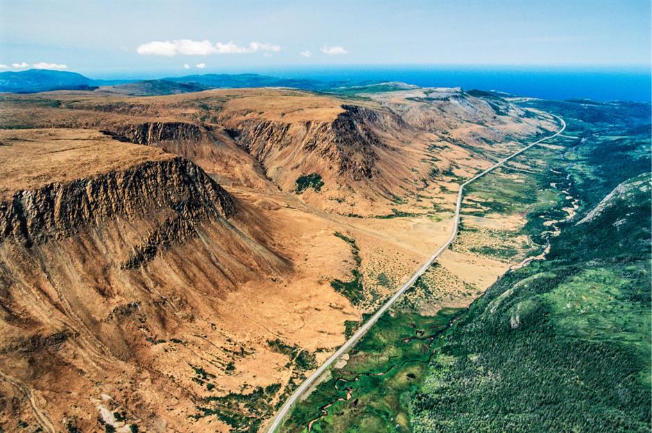
The Tablelands are a highlight at Newfoundland’s Gros Morne National Park. The result of a geological upheaval that happened half a billion years ago because of continental drift, the otherworldly rock formations are a favourite of hikers looking for some unique topography.
Twillingate, Newfoundland and Labrador
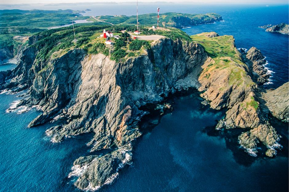
A stop along the ocean corridor known as 'Iceberg Alley', the town of Twillingate is located on Notre Dame Bay on the northeast coast of Newfoundland.
Its most striking landmark is the Long Point Lighthouse, a classic Atlantic lighthouse that has stood on the rocky shore since 1876.