Road trips: 6 UK options you can do in a day

Tracking down the best road trip to complete in just one day can be tough. Luckily for you, we’ve selected six of the best the UK has to offer
These routes, which are courtesy of Cottages in Northumberland, are all around one hundred miles and take three to four hours to drive. Better still, they include pit stops and all-essential leg stretches, with plenty of time factored in for those impromptu detours and sightseeing spots.
Covering national parks, coastal routes, nature reserves and designated Areas of Outstanding Natural Beauty, hit the road with these UK driving trips and get stuck into the best the British outdoors has to offer.
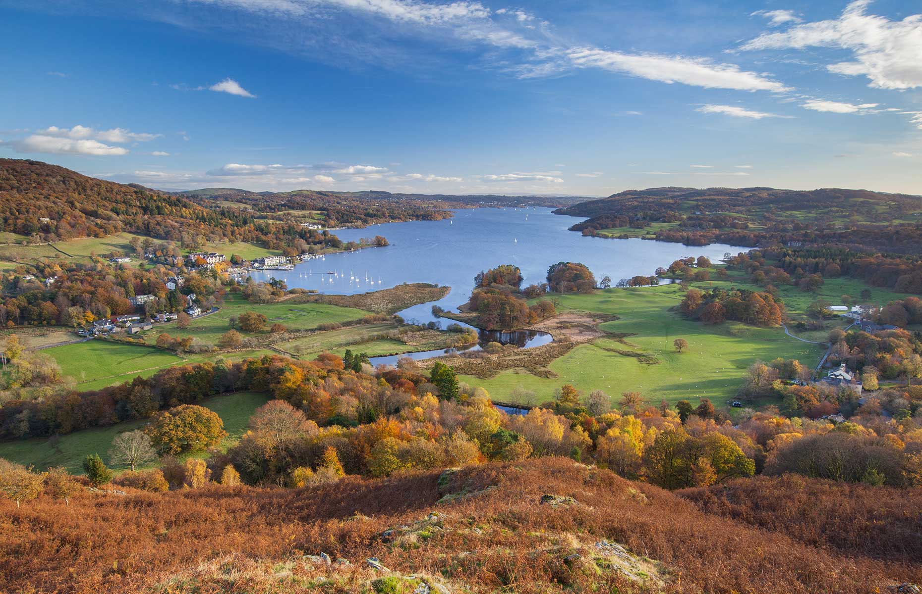
1. Berwick-upon-Tweed to Kielderhead National Nature Reserve via the Northumberland coast
Distance: 98 miles
Time: 3 hours 3 minutes
Combining countryside with coastal views, this route takes in 25 miles of coastline and 21 miles through Northumberland National Park.
Berwick-upon-Tweed teeters on the border of England and Scotland (fun fact: they’re the only Scottish football team to play in the English league) and it’s a town steeped in history, with Roman forts, Iron Age sites and stately homes. Pay a visit to Holy Island (which isn’t actually an island) and at low-tide walk up to Lindisfarne Castle (which isn’t actually a castle) to take in this former private holiday home.
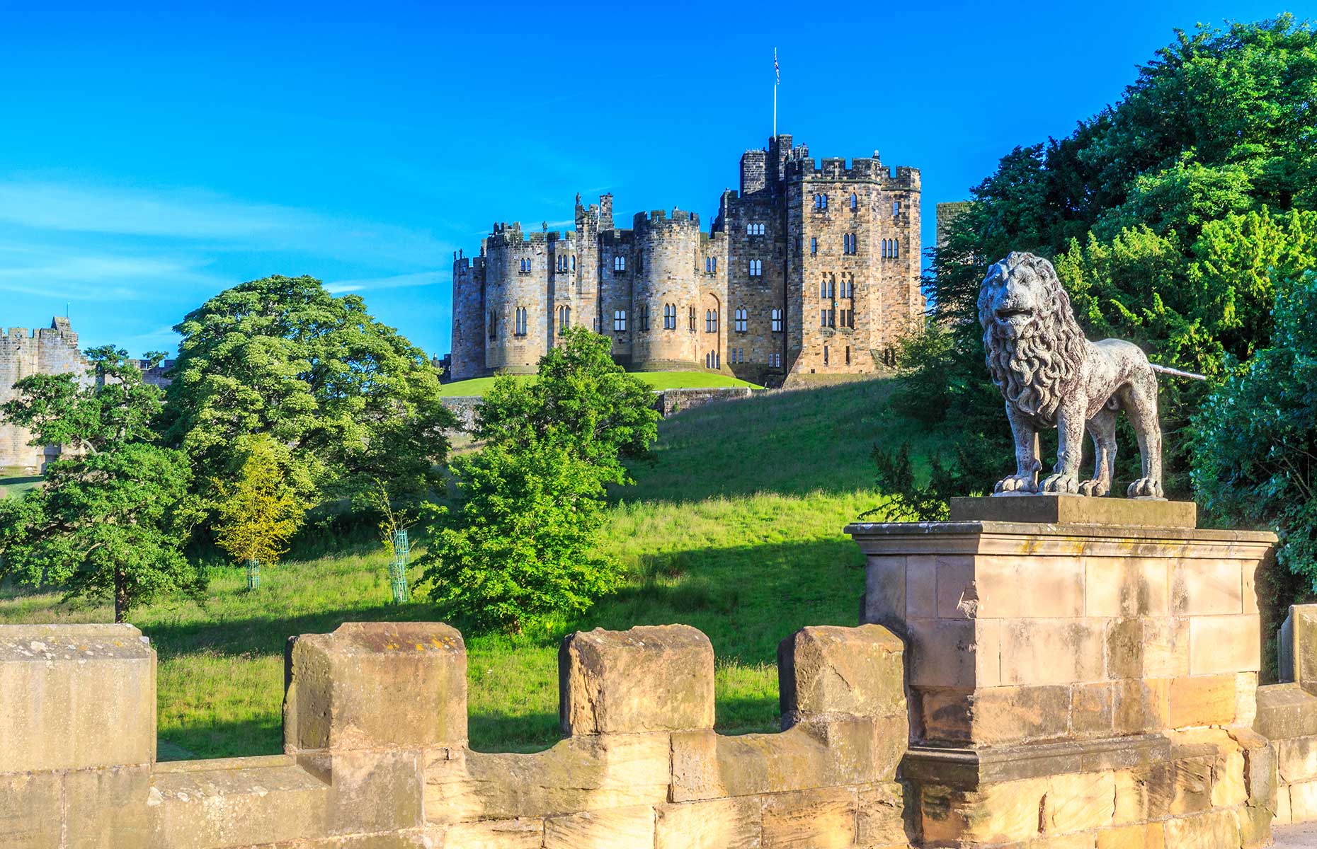
Next, on to Bamburgh, where you can visit an actual castle. This Grade I-listed building displays gleaming armour and battle-scarred weapons in grand rooms, and there’s a Victorian-styled King’s Hall with, rather interestingly, Thai touches. A short drive leads onto Alnwick Castle which Harry Potter fans will instantly recognise as Hogwarts – you can even take broomstick lessons here.
iLongLoveKing/Shutterstock
Venture away from the coast and towards Northumberland National Park, ending at Kielderhead National Nature Reserve. Park up and take the time to explore the woodland and grassland, and keep an eye out for wildlife on a walking trail. Tucking into a picnic is a well-earned way to end this route.
2. Loch Lomond to Mallaig via Glencoe and Fort William
Distance: 113 miles
Time: 2 hours 40 minutes
Winding west from Loch Lomond to Mallaig, this route makes the most of Scotland’s wild west coast, taking in seven National Scenic Areas, 16 miles of coastline and 22 miles through Loch Lomond National Park. If it's waterside vistas you’re after, look no further – this wild landscape combines craggy coastlines with a whole lotta lochs.
Loch Lomond is your starting point as you take in some 24 miles through the national park, taking in lovely little villages along the way. Stop off at Firkin Point for incredible views over the loch. Continue north to Glencoe, an ideal spot for camping, skiing and hill-walking. The valleys show off with eagles soaring over waterfalls, trails and peaks. You’ll also pass Fort William, which sits at the head of Loch Linnhe and Loch Eil.
Tomas Marek/Shutterstock
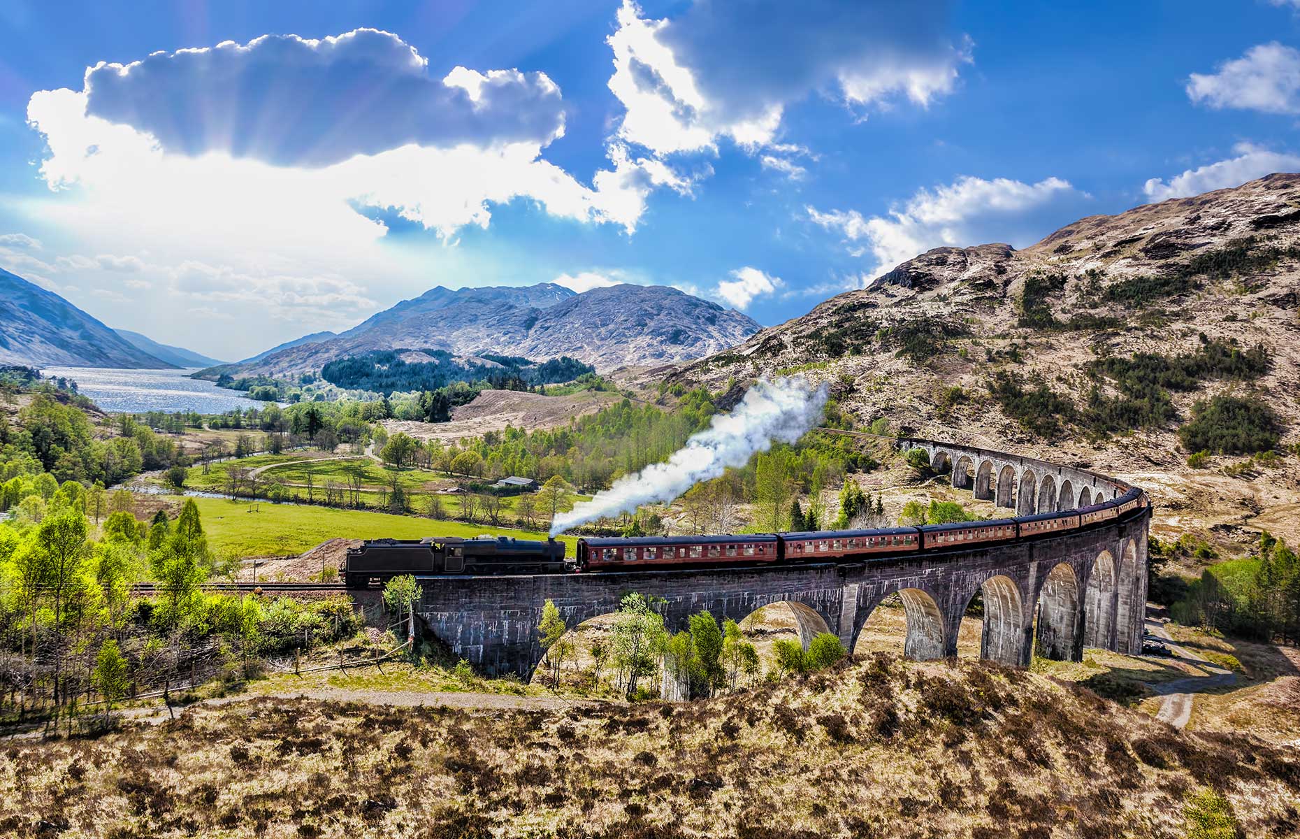
It’s not all about water reigning supreme though; the 21-arched Glenfinnan Viaduct stands 100 feet (30m) above the ground and spans 1,000 feet (305m). Try to catch sight of a steam train passing over the viaduct for a memorable experience. It’s also another iconic Harry Potter filming location.
The final forty-minute drive west brings you to the bustling fishing port of Mallaig. This marks the end of the route, where you can tuck into a hearty meal from one of the welcoming pubs; The Steam Inn is a tempting choice with seafood dishes, crackling log fires and contemporary splashes in a gastro-pub setting.
READ MORE: Searching for sharks on Scotland’s Wild West Coast
3. Aviemore to Pitlochry via Braemar
Distance: 99.5 miles
Time: 2 hours 40 minutes
Enjoy some of the best the Scottish Highlands and rural Aberdeenshire has to offer with this route that covers 73 miles of Cairngorm National Park, four National Scenic areas and the River Tay.
Starting in Aviemore, head north through the rolling hills and farmland and keep an eye out for deer, squirrels and hare. This area is also home to the Speyside Malt Whisky Trail, with plenty of opportunities to sip the local strong stuff.
lowsun/Shutterstock
Upon reaching Braemar, park up and see what the town has to offer. Wander down country lanes, pick up local produce and explore the area where the Queen comes on holiday every year – Braemar is home to Balmoral Castle.
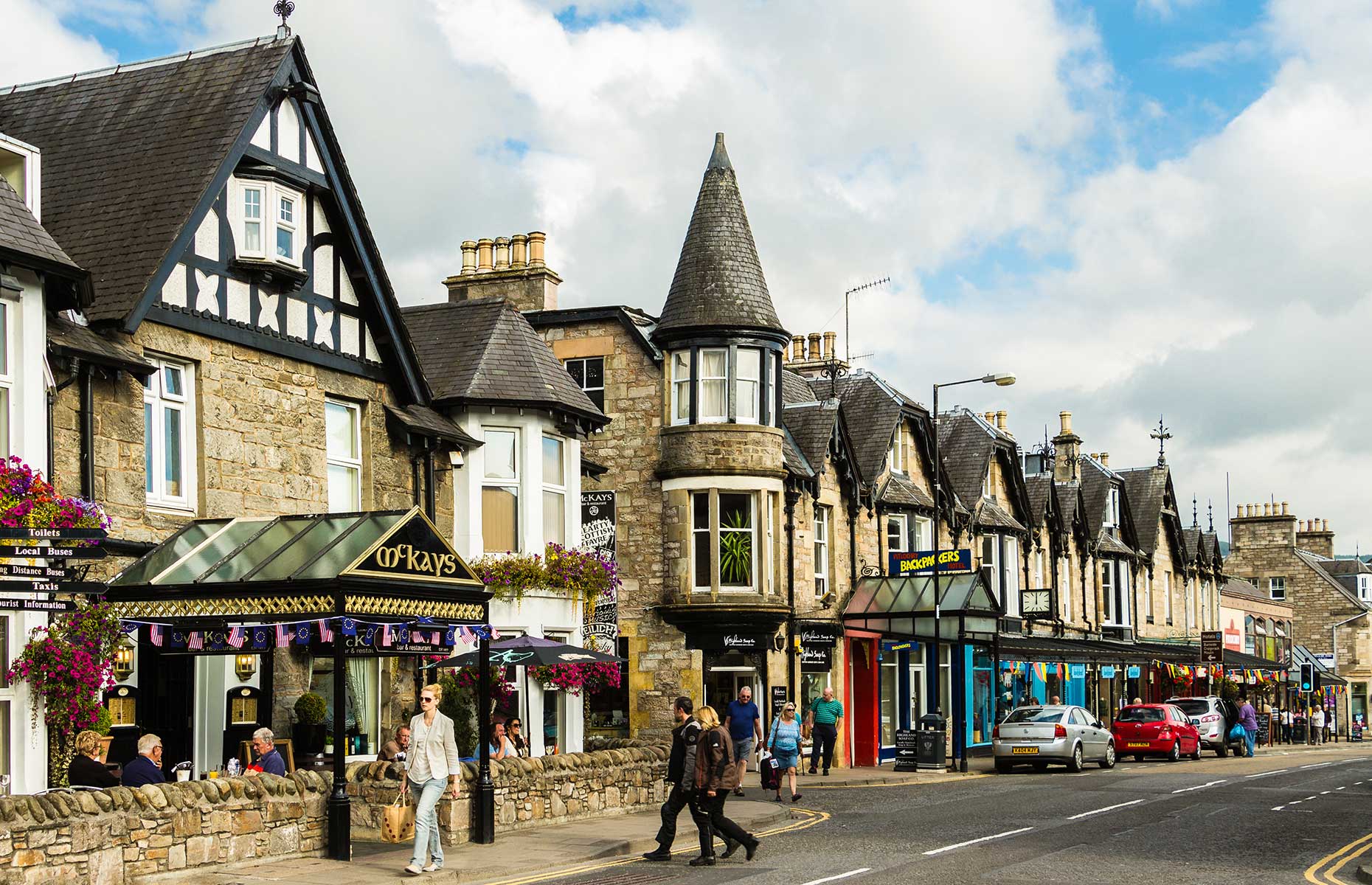
Head south to reach your final stop. Pitlochry is a Victorian town complete with period architecture and history to boot; pay a visit to the whisky distilleries and museums. There are also luxury spas, guided tours and cycling routes here, so after a day’s drive you can choose your own pace.
4. Ambleside to Harrogate via Hawes in Yorkshire Dales National Park
Distance: 90.6 miles
Time: 3 hours 2 minutes
It’s a battle of the national parks as you take on 73 miles of the Lake District and Yorkshire Dales. This route also takes in the Nidderdale Area of Outstanding Natural Beauty, with castles, nature reserves and waterfalls among other highlights.
Set off from Ambleside, one of the Lake District’s prettiest towns, and travel along the eastern side of stunning Lake Windermere. Stop off in the market town of Kendal to try the Kendal Mint Cake and mooch around the shops and boutiques, stopping off for a cup of tea along the way.
Continue east towards Garsdale and Hawes before entering Yorkshire Dales National Park.
James_Lindsay/Shutterstock
It’s easy to sit back and admire the deep valleys, heather moorland and patchwork of hay meadows, all while driving over smooth and steady roads. Follow the Clough River that runs through the park and pause at Cotter Force. This secluded waterfall is an idyllic picnic spot to sit and make the most of this natural spectacle.
Head south and venture through the Nidderdale Area of Outstanding Natural Beauty, and within 30 minutes you’ll arrive at Harrogate, your final stop. This elegant town is alive with activity; simmer away in the Turkish Baths, sample local Yorkshire fare on a guided food tour or rummage through the local antique stores to round off your road trip.
READ MORE: 6 reasons to visit Richmond, Yorkshire
5. Dartmoor National Park to Christchurch in New Forest National Park
Distance: 112 miles
Time: 3 hours 25 minutes
This southcoast scenic route encompasses ten miles of coastline, three Areas of Outstanding Natural Beauty and ten miles of national parks, and will leave you wondering why you hadn’t visited sooner.
Starting in Buckfastleigh, home to the scenic South Devon Railway, head northeast towards Exeter, a lively university city surrounding the River Exe. The road hugs the edge of the Dartmoor National Park, a rugged beauty steeped in local legend and myth. Fancy a detour? Head to Bovey Tracey or Becky Falls Ancient Woodland Park for a quick stroll.
Invisible Edit/Shutterstock
After passing Exeter, head east towards Sidmouth and Lyme Regis which brings you to the coast. This area makes up the East Devon Area of Outstanding Natural Beauty – you needn’t leave your car to appreciate the gorgeous landscape.
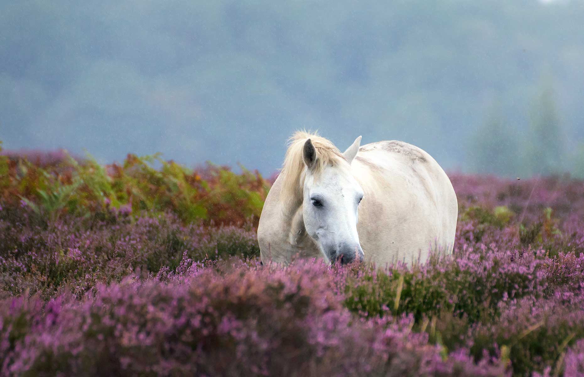
The final stretch leads through the Dorset Area of Outstanding Natural Beauty and onto Christchurch. This waterside town is an ideal place to spend an afternoon with coastal nature reserves, award-winning beaches and independent shops to check out. Otherwise you can continue on to the nearby New Forest National Park. This former royal hunting ground is today ideal for walking and camping, with wild ponies to look out for.
6. Snowdonia National Park to the Isle of Anglesey (loop)
Distance: 98 miles
Time: 2 hours 45 minutes
See the best North Wales has to offer with this loop round Anglesey. Covering 15 miles of national park, 20 miles of coastline and the entirety of Anglesey, there are plenty of local attractions and landmarks to take in and stop off at.
The starting point is Snowdonia National Park, where you’ll head north west and take in the hills and lakes of Glyder Fawr, Carnedd Llewelyn and Llyn Ogwen along the way. Avoid the motorway and stick to the smaller roads with towns and villages dotted along the way.
Martina Hardiman/Shutterstock
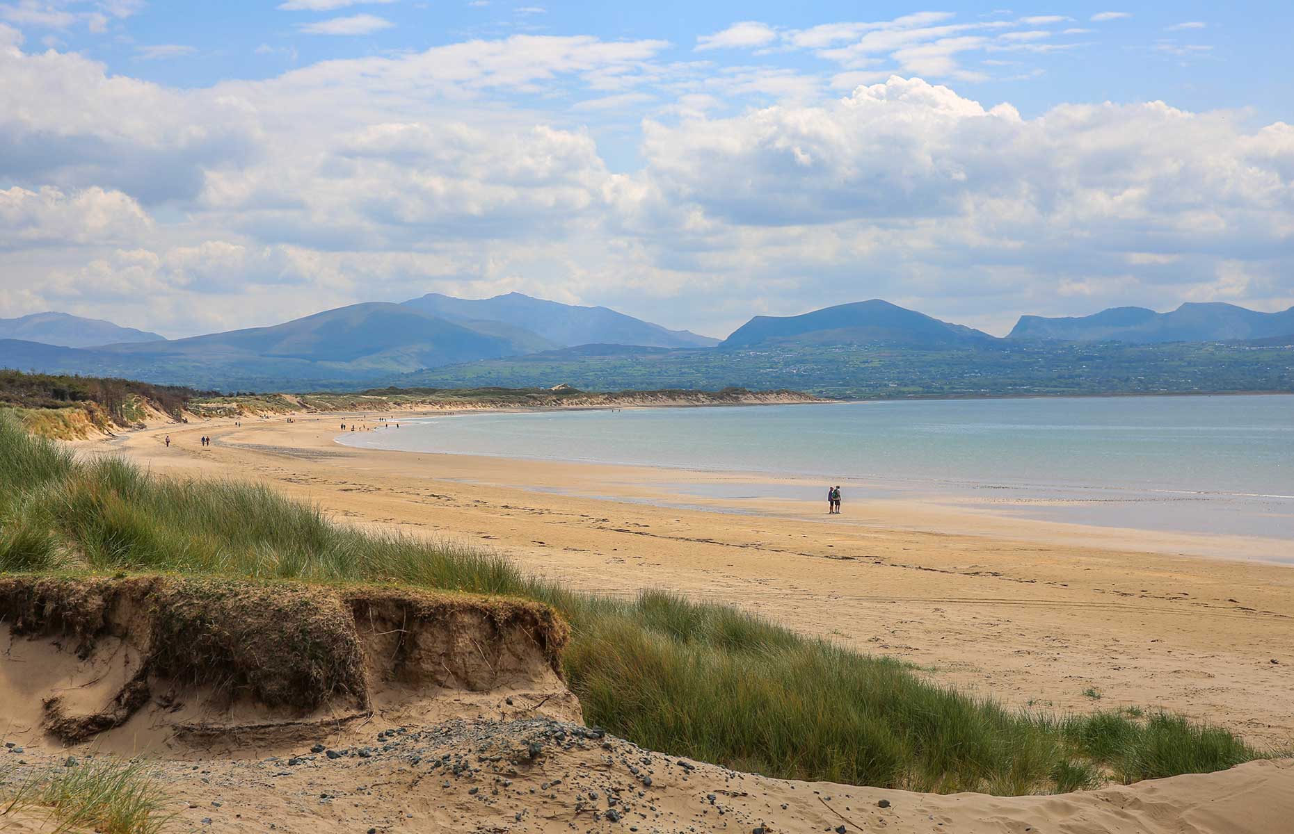
Cross Britannia Bridge into Anglesey, where you’ll soon reach Llanfairpwllgwyngyllgogerychwyrndrobwllllantysiliogogogoch. Unsurprisingly this is the second-longest place name in the world, and roughly translates as "The church of St. Mary in the hollow of white hazel trees near the rapid whirlpool by St. Tysilio's of the red cave"... got it? Stop off at the train station for a selfie in front of the sign. Then steer east and stick to the coast to take your pick from a roster of splendid beaches: Llanddona Beach, Traeth Benllech, Traeth Bychan and Traeth Porth Wen Beach, to name a few.
Keep east and head north towards the Port of Holyhead. Here, you can either walk a section of the 130-mile-long Isle of Anglesey Coastal Path or simply sit back and watch the ferries crossing the ocean towards Ireland. Head back onto the mainland to complete this day trip to remember.
READ MORE: The best glamping holidays in the UK
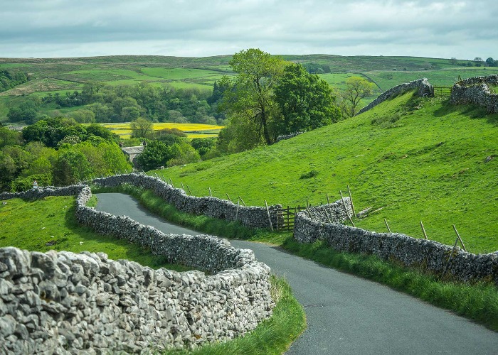
Lead image: Chee Hoong Loh/Shutterstock
Comments
Be the first to comment
Do you want to comment on this article? You need to be signed in for this feature