Secrets of the world’s most mysterious islands
Isles of intrigue
Scattered across the world’s oceans are islands cloaked in secrecy, where history and legend collide. From remote atolls contaminated by nuclear and biological experiments to lands concealing hoards of pirate treasure, extraordinary otherworldly ecosystems and remnants of lost civilisations, these curious locations defy easy explanation. Each isle tells a story of the unknown, the forgotten or the purposefully hidden.
Click through this gallery to discover the world’s most mysterious islands that blur fact and folklore...
Oak Island, Nova Scotia, Canada
Oak Island, just off the south shore of the Canadian province of Nova Scotia, has been the location of an ongoing treasure hunt for more than 200 years. The origins of the 140-acre isle's rich mythology date back to 1795, when Daniel McInnis discovered a circular depression in the ground. McInnis and his friends dug the site up, revealing a deep shaft punctuated with oak platforms.
According to local legend, pirate treasure looted by the likes of Blackbeard and Captain Kidd is buried on the island, so the discovery ignited the imaginations of amateur explorers. The circular excavation site, which is visible here, was consequently named the Money Pit.
Oak Island, Nova Scotia, Canada
In 1804, a stone slab inscribed with symbols was supposedly uncovered 90 feet (27m) down in the shaft. While the location of the stone is now unknown (if it ever existed), a possible translation from 1949 reads, "Forty feet below, two million pounds are buried." Early searches also apparently uncovered a system of tunnels and drains leading to the sea that would flood the shaft when excavations reached certain depths.
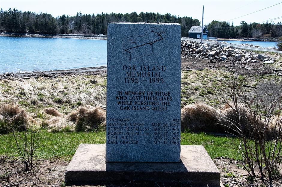
Explorations have proven incredibly dangerous over the centuries, with at least six people known to have died in pursuit of the elusive fortune. Those lost are commemorated on this memorial stone on the island's shore.
Sponsored Content
Oak Island, Nova Scotia, Canada
Over the years more shafts have been dug at the site, but nothing of note has come to light. The lure of buried treasure even enticed Franklin D Roosevelt, who took part in an expedition in 1909 before becoming US president. In recent decades, interest in the mystery has heightened once again thanks to The Curse of Oak Island, a History Channel reality show following the plight of treasure hunters.
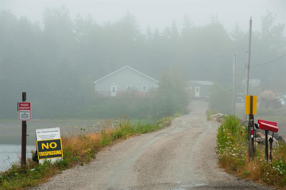
Oak Island is privately owned, and signs warning against trespassing pepper the isle. Members of the public are only allowed access on pre-booked guided tours.
Enewetak Atoll, Marshall Islands
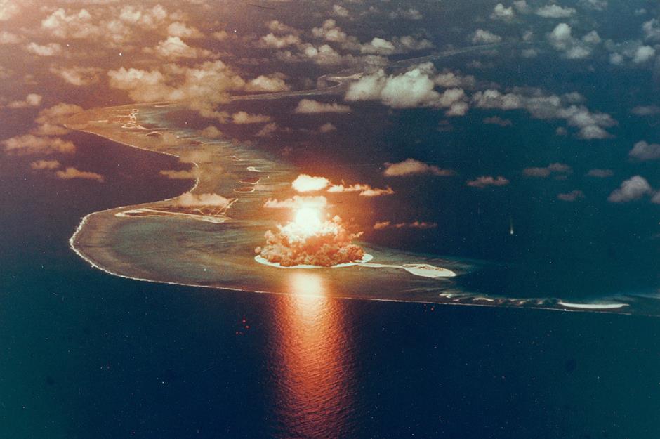
The Marshall Islands may look like a tropical paradise, but the remote Pacific nation has a secretive past. The seizure of the chain of isles by the US from Japan in 1944 signalled the start of a dark new chapter in which the atolls became a testing ground for nuclear weapons.
Pictured here is Enewetak Atoll, a chain of 40 coral islands that bore the brunt of a series of Cold War experiments. The fireball rising over the landmass was caused by the Seminole nuclear blast, part of a series of thermonuclear bomb tests in 1956 known as Operation Redwing. Information regarding the experiments has only been declassified in recent decades.
Enewetak Atoll, Marshall Islands
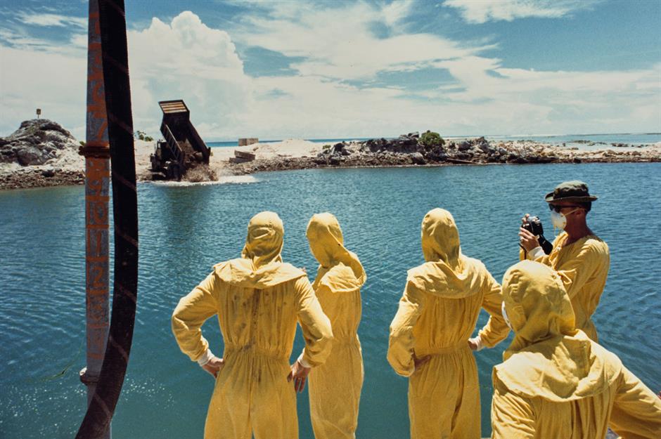
In total, 67 nuclear detonations took place on the Marshall Islands between 1946 and 1958, with 44 of those tests carried out near Enewetak Atoll. To make matters worse, Runit Island, part of the Enewetak chain, was used as a dumping ground for radioactive waste from the 1970s.
This image from 1978 shows a group of American military officers in overalls watching as a mixture of contaminated soil, nuclear waste and concrete is deposited into a bomb crater on the tip of Runit Island. The toxic site was then topped with a 377-foot-wide (115m) concrete dome.
Sponsored Content
Enewetak Atoll, Marshall Islands
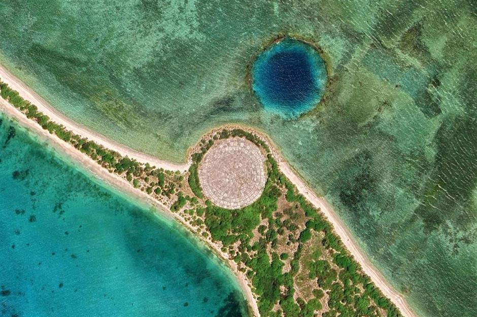
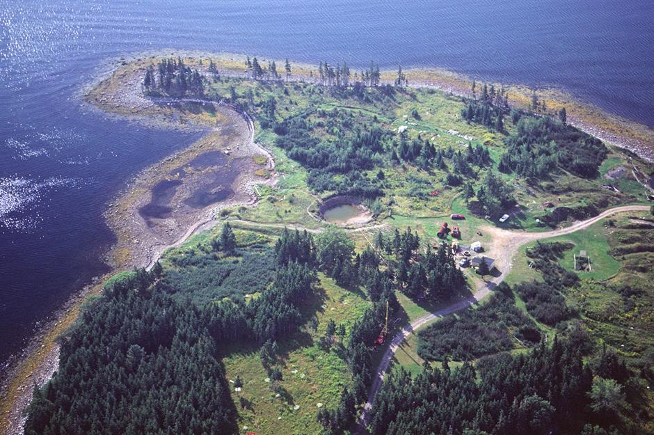
This is what Runit Island looks like today. Offshore, you can see a crater formed by the Lacrosse nuclear test in 1956, carried out as part of Operation Redwing. On the edge of the island is the dome built to contain the nuclear waste, which locals call 'the tomb'. Scientists have said that the dome is vulnerable to rising sea levels and at risk of collapsing, which could be catastrophic for the islands and their people.
In 2012, a United Nations report declared that the impact of radiation on the Marshall Islands had caused “near-irreversible environmental contamination”. The Marshallese people continue to campaign for restitution and the cleanup of their home.
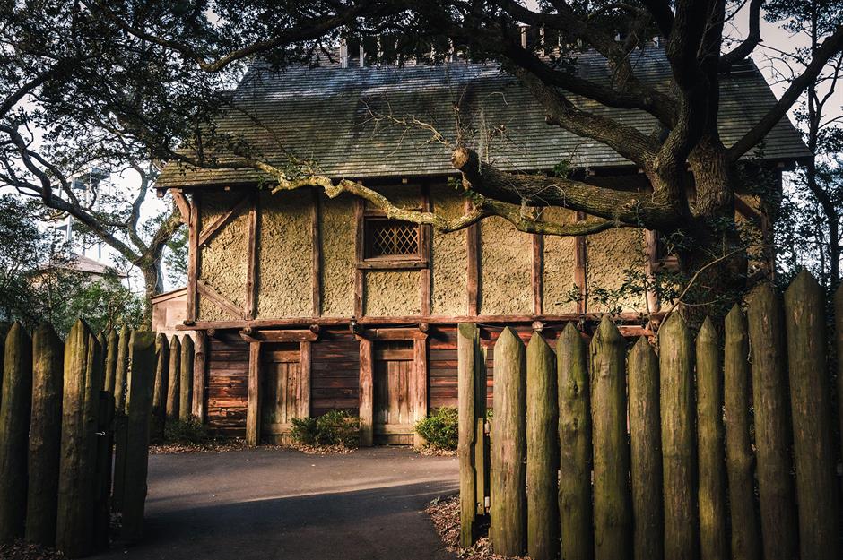
Roanoke Island, North Carolina, USA
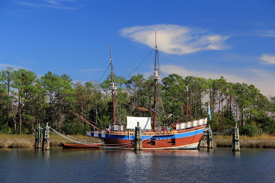
Located off the coast of North Carolina, Roanoke Island is the site of one of the most perplexing mysteries in American history. After failing to establish the first English colony on the isle in 1585, British explorer Sir Walter Raleigh dispatched a second voyage of colonists in 1587 in ships resembling the vessel pictured here. While their destination was Chesapeake Bay, they were brought ashore on Roanoke Island instead.
Among the 118 settlers was the expedition leader, John White, and his pregnant daughter, Eleanor Dare, who would give birth to the first English child in the Americas.
Roanoke Island, North Carolina, USA
Life on Roanoke Island was hard, and the colonists had fractious relationships with the local Algonquian, Secotan and Croatoan Native American tribes. After just a month, John White made the arduous journey back to England to pick up more supplies and settlers. Once White had rejoined the group, they planned to head inland to find a more suitable settlement site.
However, White's hopes of a quick return to Roanoke were dashed when an attempted invasion by the Spanish Armada saw all vessels requisitioned to defend England. When White finally reached Roanoke in 1590, he found the settlement deserted. The only hint as to the colonist's fate was the word 'CROATOAN' carved into a post.
Sponsored Content
Roanoke Island, North Carolina, USA
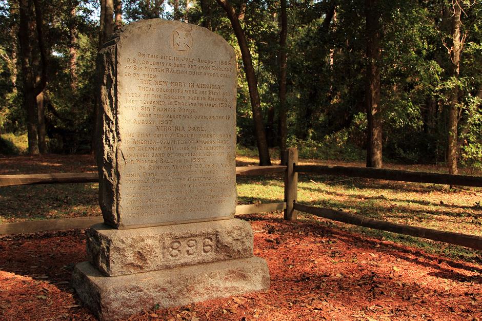
White immediately set sail for the island of Croatoan, inhabited by the Indigenous peoples of the same name, but a storm forced his return to England and the lost colony was never found. For centuries theories have been floated about the fate of the settlers. There were no signs of a struggle at the camp, and White noted that the buildings had been dismantled, suggesting the colonists left of their own accord.
Given the message left behind, one of the more plausible explanations is that the group relocated to Croatoan, as White had suspected. This monument on Roanoke is dedicated to the colonists and the birth of White's granddaughter, Virginia Dare.
Gruinard Island, Wester Ross, Scotland, UK
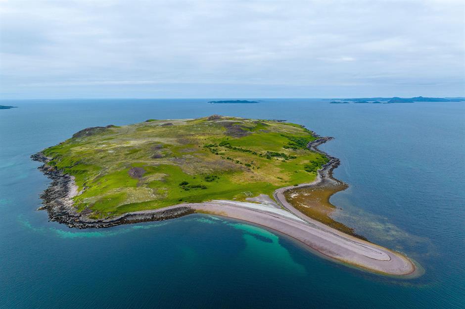
Situated off the west coast of Scotland, Gruinard Island is an isolated outpost that has long invited intrigue. While it may look like rugged, unassuming wilderness, it hides a deadly secret that saw the isle declared off-limits for almost half a century.
During World War II, Gruinard's remoteness piqued the interest of the UK Ministry of Defence. The government was searching for a contained location to conduct biological experiments that would yield powerful weapons it could use against the enemy. The War Office purchased the 522-acre island in 1942 and began carrying out tests in secrecy.
Gruinard Island, Wester Ross, Scotland, UK
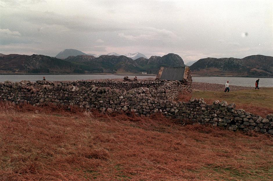
Gruinard was already deserted when an army of government scientists descended. The only signs of life on the outcrop were a few rudimentary stone structures left by its previous residents, who had abandoned the isle by 1920.
In the small villages along the bay on the mainland, no one knew of the top-secret project that was being conducted just across the water. However, rumours soon began to swirl among locals as sheep, cows and horses began to unexpectedly die.
Sponsored Content
Gruinard Island, Wester Ross, Scotland, UK
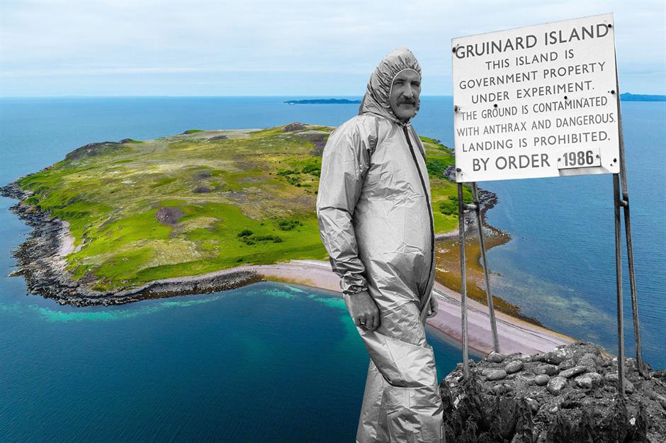
What occurred on Gruinard was only revealed after a film detailing the experiments was declassified in 1997. The island had been a test site for the development of an anthrax bomb, designed to release deadly spores. Sheep were tethered across the outcrop and exposed to a potent anthrax cloud. Within days, they had all perished.
Deemed a success, the experiments concluded in 1943. However, the soil remained contaminated with anthrax for decades, and access to the isle was prohibited for 48 years. Gruinard was finally decontaminated and declared safe in 1990, but secrecy still shrouds this alarming period of the island's history.
Easter Island, Chile
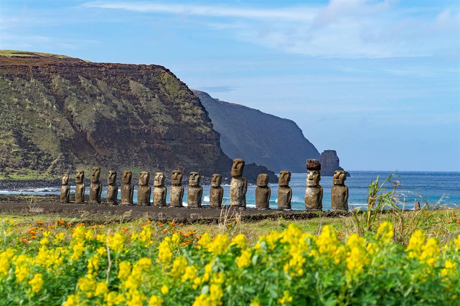
One of the most remote inhabited islands in the world, Easter Island, also known as Rapa Nui, is a Chilean territory in the middle of the South Pacific. Hundreds of thousands of tourists visit the isolated outpost every year, drawn by the mysterious stone statues, called moai, that preside over the land.
These curious figures are remnants of the Rapu Nui culture, the roots of which can be traced back to a group of Polynesian settlers who discovered the island toward the end of the first millennium AD. Between the 11th and 17th centuries, a remarkable civilisation flourished here, capable of sophisticated art and engineering. The culture's sudden end is still the subject of speculation today.
Easter Island, Chile
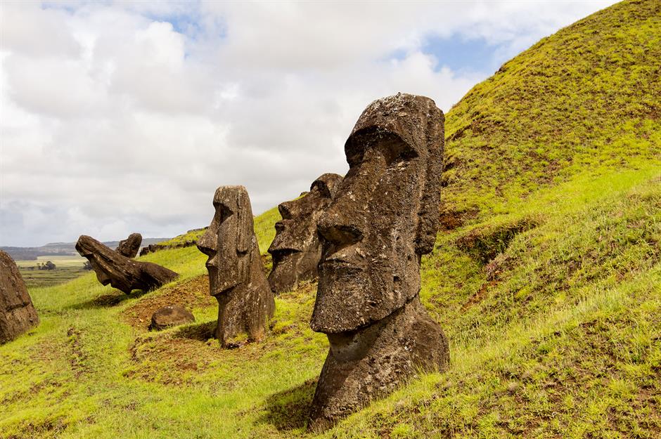
Easter Island has more than 900 moai statues, thought to have been created by the Rapa Nui people between 1250 and 1500. The monoliths, which depict human figures, are staggeringly heavy and weigh up to 86 tonnes. While it isn't clear how they were transported across the island from the quarry where they were carved, their angular bases suggest they may have been designed to rock forward in a side-to-side motion, almost like walking, with the help of guide ropes.
Intrigue also surrounds the purpose of the enormous figures. The most common theories are that the moai were created to honour ancestors and guard the community, but scientists have also suggested that the statue's locations mark sources of freshwater.
Sponsored Content
Easter Island, Chile
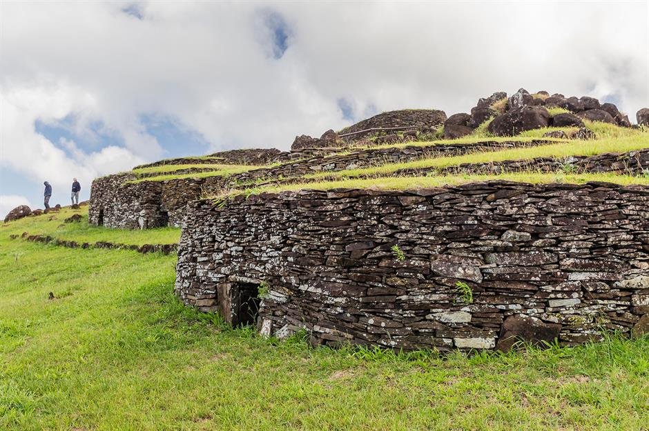
Pictured here are restored stone houses at Orongo, a ceremonial village on the island used by the Rapu Nui people during the era of the Birdman religious cult, which had replaced the worship of the moai by 1600.
It's said that by the time Europeans landed on the island in 1722, the Rapa Nui culture had collapsed and its population had dwindled. The reasons for this are contested. Some say the isle's resources were severely depleted, leading to wars and famine, while others insist the society was stable until the arrival of Europeans, who exploited the island and carried diseases that decimated the population.
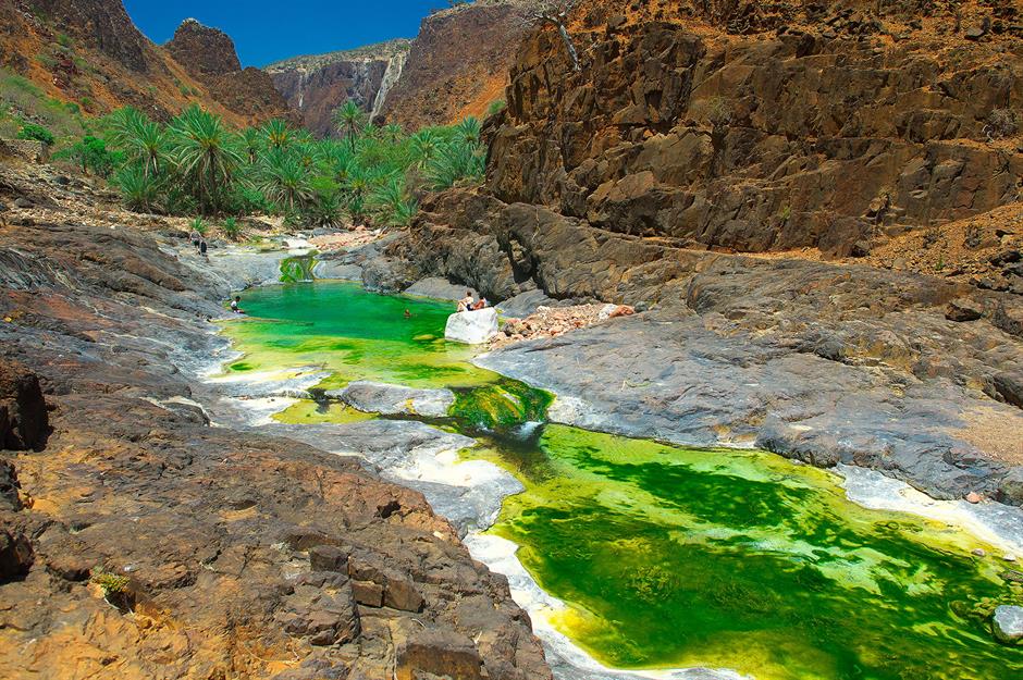
Socotra, Yemen
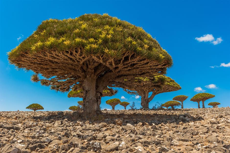
Stepping onto the island of Socotra in the Indian Ocean is like stepping onto the surface of an alien planet. The Yemeni territory's remote location just off the Horn of Africa, coupled with its extreme arid climate, has forged one of the most biodiverse landmasses on Earth.
More than a third of its plant life is unique to the island, resulting in mysterious, otherworldly landscapes unlike anything elsewhere. One species that only grows on the isle is the dragon's blood tree, with its mushroom-shaped canopy and blood-red sap.
Socotra, Yemen
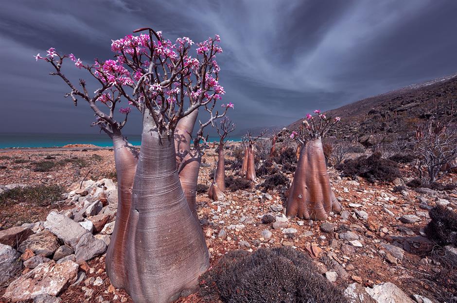
These strange shapes rising from the desert floor are bottle trees, which are also endemic to Socotra. They're named after their wide trunks, which store water to help them survive in the dry terrain.
As well as unusual flora, the island is home to an array of unfamiliar creatures. 90% of its reptile species and 95% of its land snail species are only found on Socotra. The isle offers a vital habitat for endangered birds too, along with a diverse marine ecosystem that includes 300 species of crab, lobster and shrimp and 253 species of reef-building corals.
Sponsored Content
Socotra, Yemen
Visitors have been captivated by Socotra's mystical landscapes for centuries. According to local legend, legendary Macedonian general Alexander the Great was especially enchanted by its unique plants and wildlife.
Three quarters of Socotra's land was designated a UNESCO World Heritage Site in 2008, but the isolated outpost isn't immune to the effects of urbanisation, deforestation and global warming. In a bid to protect its biodiversity, two community nurseries have been opened on the island to help restore the dwindling dragon's blood forests and preserve this extraordinary place for generations to come.
Isla de las Muñecas, Mexico City, Mexico
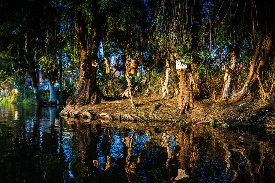
In the southern sprawl of Mexico City, a maze of canals meanders through the suburb of Xochimilco. The waterways, which connect a series of tiny artificial islands, were created by the Aztecs, who established the capital of their empire here in the 14th century.
Among the man-made isles, known as chinampas, is a particularly unnerving sight. La Isla de las Muñecas, which means 'the Island of the Dolls', is one of the city's eeriest and most mysterious landmarks. Approaching the shoreline, visitors are greeted by an army of dishevelled dolls strung up among the trees – the island's only inhabitants.
Isla de las Muñecas, Mexico City, Mexico
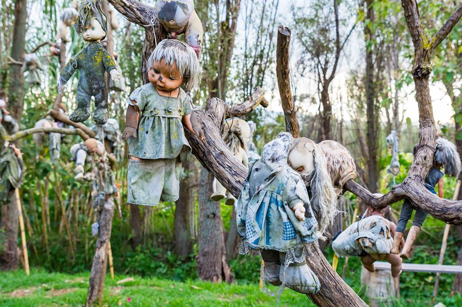
The isle's late caretaker, Don Julián Santana, is said to be responsible for the strange residents. According to local legend, a young girl tragically drowned near the chinampa in the 1950s, and Don Julián reportedly found the girl's doll. He hung the doll on a nearby tree to honour her spirit. However, some sources claim the enigmatic hermit fabricated the story.
Whatever the truth of its origins, Isla de las Muñecas has grown into a chilling spectacle that draws visitors from across the world. The island's macabre collection has steadily grown over the decades, and there's now said to be around 4,000 dolls on the isle.
Sponsored Content
Isla de las Muñecas, Mexico City, Mexico
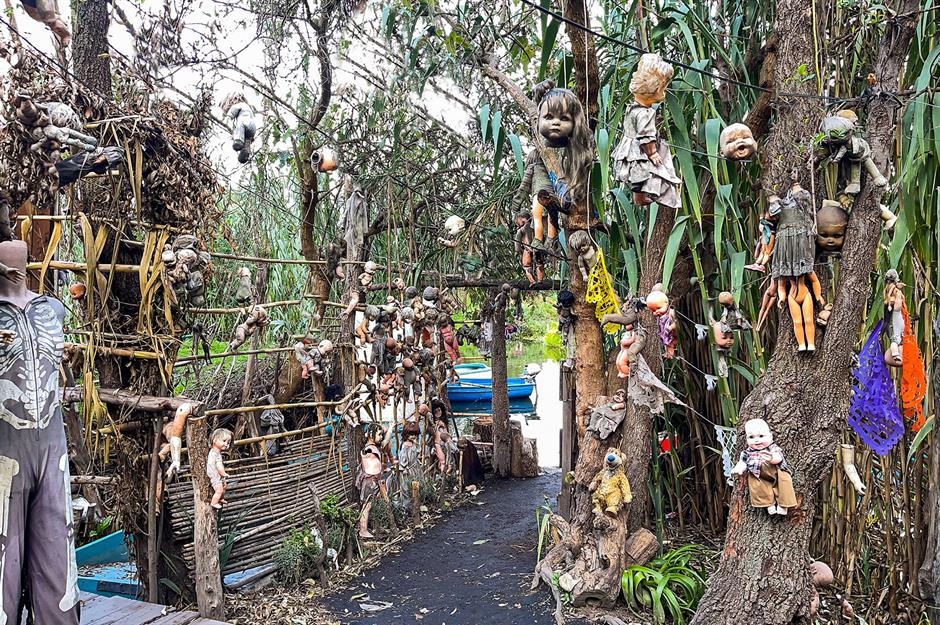
The tiny chinampa is mostly undeveloped. There's no electricity or running water, and concrete constructions are forbidden. Instead, there are a number of primitive wooden buildings that house shops. Inside, the structures are clad with dolls – they're mounted on the walls and hang from the ceilings.
Don Julián passed away in 2001, near the spot where the young girl reportedly died. Today, Isla de las Muñecas is open to the public and holds the Guinness World Record for the largest collection of haunted dolls.
Now discover these abandoned islands that the world left behind