Borders and beyond: 20 striking natural, political and geographical crossings worldwide
Across the divide
From jagged mountain ridges to serene lakes, the world’s borders are as diverse as the cultures they separate. These striking boundaries mark the spots where landscapes clash, histories collide and identities have been shaped over millennia. Whether carved by rivers, walls or centuries of conflict, these borders reveal the friendships and tensions existing between neighbouring nations.
Click through this gallery to explore the strangest and most striking national borders on Earth...
Heaven Lake: China-North Korea
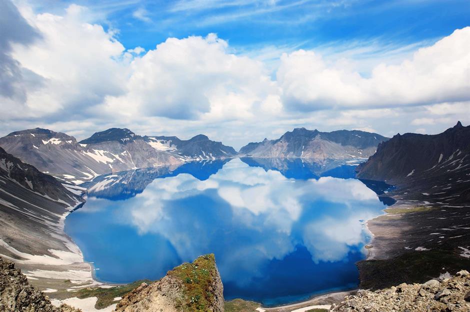
Formed by a massive eruption in AD 946, Heaven Lake – or Tianchi in Mandarin – fills a volcanic crater atop a mountain known as Changbai in China and Paektu in Korea. It straddles the China-North Korea border and is sacred in Korean mythology as a sentient being and the birthplace of Korea's legendary founder. In North Korea it's also claimed that former supreme leader Kim Jong-il was born nearby.
Heaven Lake is believed to be the home of the Loch Ness-style Tianchi monster. The lake is 1,260 feet (384m) deep, so it's hard to disprove!
Brenner Pass: Austria-Italy
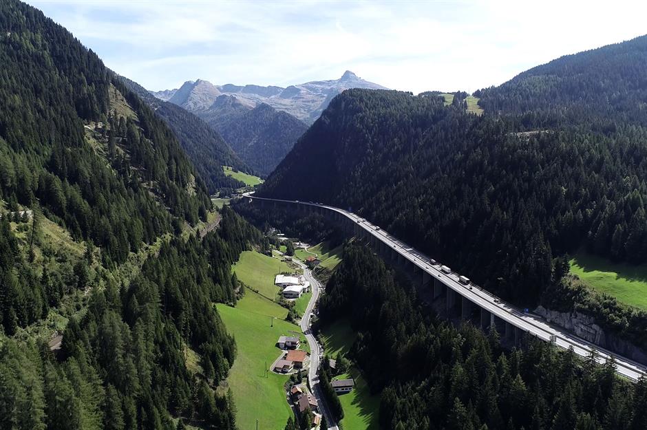
As the lowest Alpine crossing between Austria and Italy, the Brenner Pass has been used since prehistoric times. The Romans were the first to build a physical road there in the 2nd century AD, and by the 14th century it had become one of Europe's most important trading routes. The picturesque pass became an official border after World War II, and these days it links Innsbruck and Verona via rail and motorway.
Sponsored Content
Peace Arch: Canada-USA
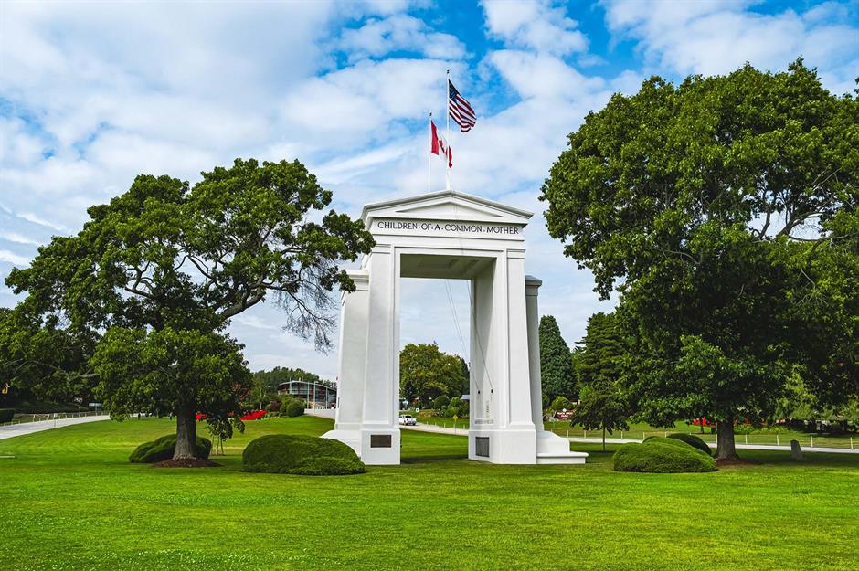
Built in 1921, the Peace Arch straddles the Canada-USA border between Surrey, British Columbia and Blaine, Washington. It symbolises over two centuries of peace since the War of 1812 between Britain and America.
Inscriptions on the frieze read "Children of a Common Mother" and "Brethren Dwelling Together in Unity". The surrounding international park allows visitors to wander freely within its bounds, no passport needed. It’s one of the few border crossings marked by a monument to friendship.
Øresund Bridge: Denmark-Sweden
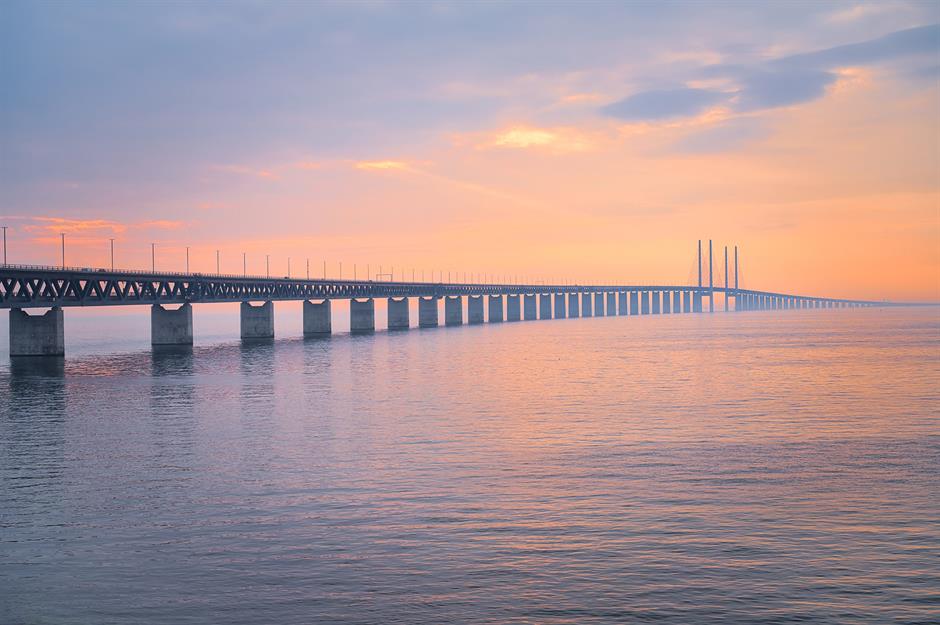
The Øresund Bridge links Copenhagen in Denmark to Malmö in Sweden, and was jointly opened by Danish and Swedish royalty in 2000. The breathtaking five-mile (8km) cable-stayed bridge links to a 2.5-mile (4 km) underwater tunnel via an artificial island built to protect marine life. It’s Europe’s longest combined road-rail bridge and also carries a major internet data cable between Scandinavia and Central Europe.
The Khunjerab Pass: China-Pakistan
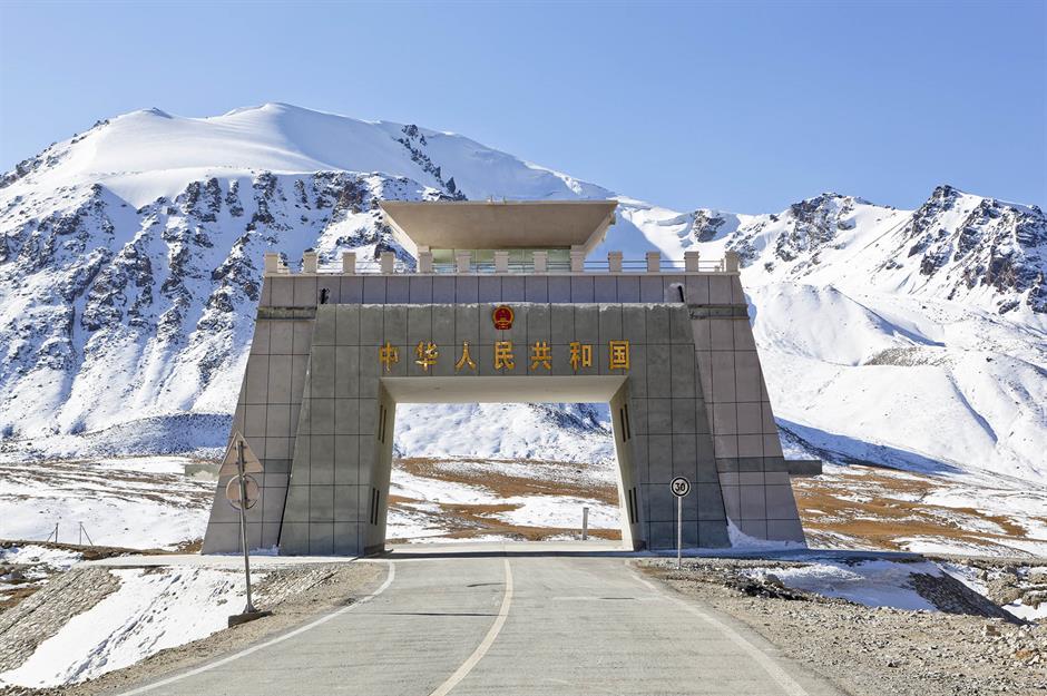
At 15,397 feet (4,693m), the Khunjerab Pass is the world’s highest paved international border crossing, linking Pakistan’s Gilgit-Baltistan with China’s Xinjiang via the Karakoram Highway. Completed in 1982, it replaced older, more dangerous caravan routes like Mintaka Pass, part of the old Silk Road network.
The name is said to mean 'Valley of Blood' in the local Wakhi language, harking back to ancient battles. It now hosts the world’s highest ATM and, as of 2025, is open year-round despite heavy snow in winter.
Sponsored Content
Lake Victoria: Kenya-Tanzania-Uganda
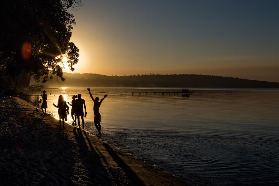
Lake Victoria, Africa’s largest lake, forms a triple border between Kenya, Tanzania and Uganda. Locally known as Nalubaale (Uganda) and Nam Lowe (Kenya), it spans 26,828 square miles (69,484sq km) and hosts more than 200 fish species, including many not found elsewhere.
Visitors enjoy birdwatching, boat safaris, kayaking, fishing and exploring the lake's ancient islands, which feature 2,000-year-old rock art. Rubondo Island is a national park in its own right and is home to chimpanzees, monkeys, elephants, fish eagles and African grey parrots.
Wagah-Attari border: India-Pakistan
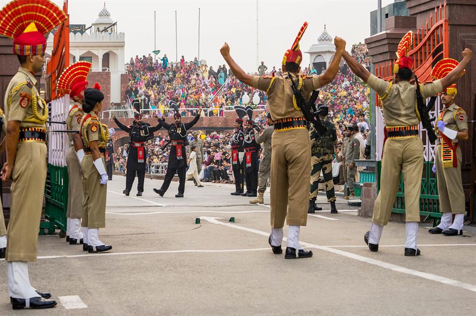
Every evening, the Wagah-Attari Border erupts in a high-energy spectacle as Indian and Pakistani soldiers perform the Beating Retreat ceremony – stomping, high-kicking and saluting in perfect sync – in front of cheering crowds.
Established in the late-1950s, it's located between Amritsar in India and Lahore in Pakistan, and is the only legal road crossing between the two countries. The spectacle draws crowds daily, blending military theatre with deep symbolism of rivalry, pride and history. The ceremony has been occasionally suspended at times of heightened tension, but is running at the time of writing.
Third Thai-Lao Friendship Bridge: Thailand-Laos
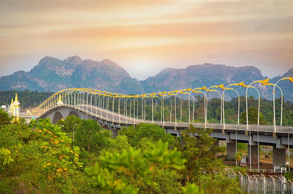
The Third Thai-Lao Friendship Bridge spans the Mekong River between Nakhon Phanom, Thailand and Thakhek, Laos. Opened in 2011, it’s 4,669 feet (1,423m) long and was built to boost regional trade and tourism. Somewhat bizarrely, traffic switches sides mid-bridge as Thailand drives on the left and Laos drives on the right.
Home to more than 1,100 fish species, the Mekong is the third most biodiverse river in the world. Lucky visitors may spot giant freshwater stingrays, turtles, monitor lizards, rare Irrawaddy river dolphins and Mekong giant catfish – which grow up to 10 feet (3m) long.
Sponsored Content
Iguazu Falls: Argentina-Brazil
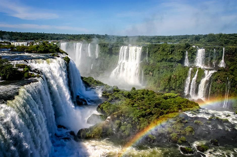
Iguazu Falls spans the border between Argentina and Brazil, forming the world’s largest waterfall system with around 275 cascades. Taking its name from the local words for 'big water', it was first recorded by a Spanish explorer in 1541.
Devil’s Throat, the most dramatic section of the falls, plunges 269 feet (82m) into misty rainforest, which is home to jaguars, toucans and the coati, an unusual tree-climbing mammal. Protected by national parks on both sides, Iguazu is a UNESCO World Heritage Site and a must-see for tourists.
The Bridge of Friendship: Bulgaria-Romania
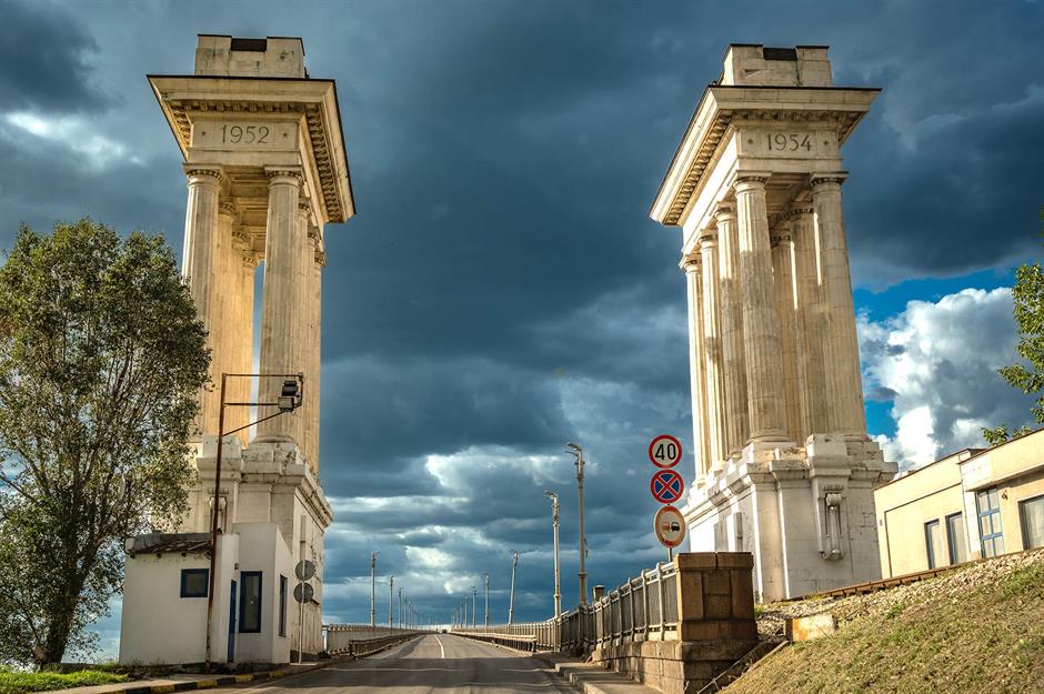
The Bridge of Friendship, also known as the Danube Bridge, connects Ruse, Bulgaria and Giurgiu, Romania. It opened in 1954 and was the first bridge over the Danube between the two countries. A pair of columned buildings stands at each end; originally border control posts, they were inspired by Soviet monumental architecture, reflecting the Soviet Union’s involvement in the bridge's construction.
Spanning 7,293 feet (2,223m), it carries road, rail and pedestrian traffic. Much like London's Tower Bridge, its central span lifts to allow tall ships to pass beneath.
Tijuana border wall: Mexico-USA
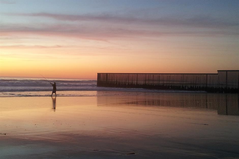
The Tijuana-San Diego border wall marks one of the busiest crossings between Mexico and the USA. The first barrier was built in the 1990s, and today dual fences stretch from the shores of the Pacific Ocean inland, monitored by sensors and patrols.
Locals call it 'la línea', and parts of the wall have become enormous canvases for protest art. Despite its imposing and at times intimidating presence, Tijuana’s urban culture thrives within touching distance of the steel divide.
Sponsored Content
Victoria Falls: Zambia-Zimbabwe
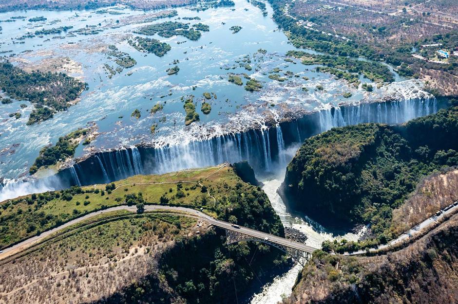
Victoria Falls, straddling the Zambia-Zimbabwe border on the Zambezi River, is the world’s largest sheet of falling water at 5,603 feet (1,708m) wide and 354 feet (108m) high.
Named after Queen Victoria by explorer David Livingstone in 1855, it’s known locally by the far more evocative name Mosi-oa-Tunya or 'The Smoke That Thunders'. The Victoria Falls Bridge connects the nations and offers stunning views – as well as the chance to bungee jump right over the river.
Mount Roraima: Brazil-Guyana-Venezuela
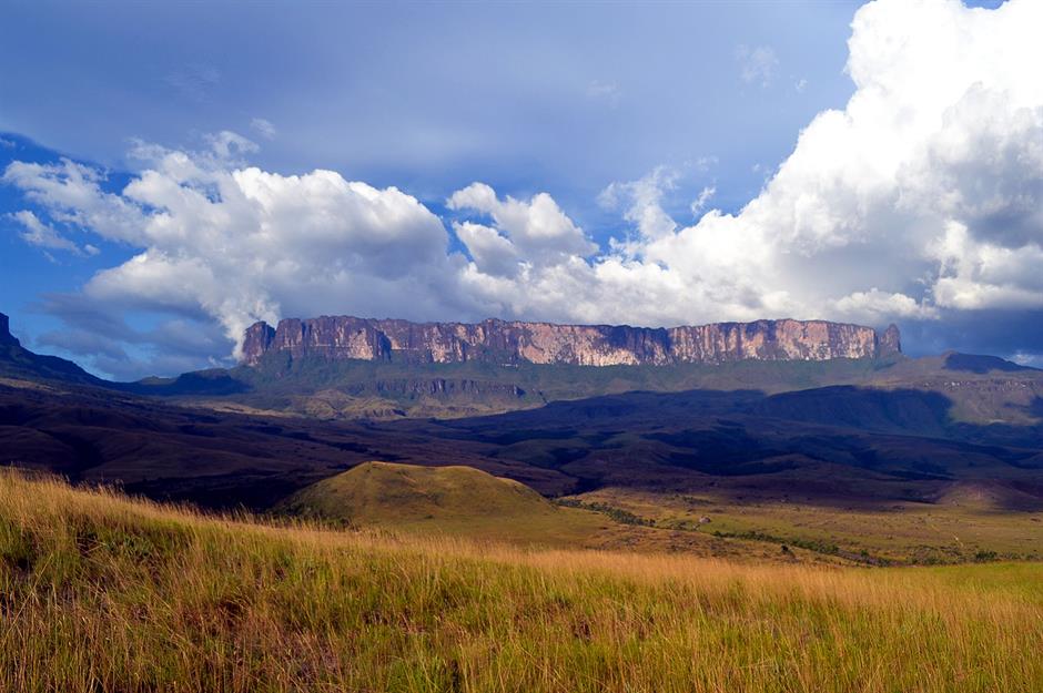
Mount Roraima marks the three-way border between Brazil, Guyana and Venezuela atop a dramatic flat-topped tepui or table-top mountain. A stone marker placed in 1931 lets visitors stand in three countries at once.
The summit hosts rare plants, sheer cliffs and ancient rock formations over two billion years old. Sacred to the Indigenous Pemon people, it inspired Arthur Conan Doyle’s The Lost World. Access is easiest from Venezuela, though Guyana’s side of the marker is nearly blank, due to a border dispute with Venezuela that has rumbled on since 1962.
Sixaola River: Costa Rica-Panama
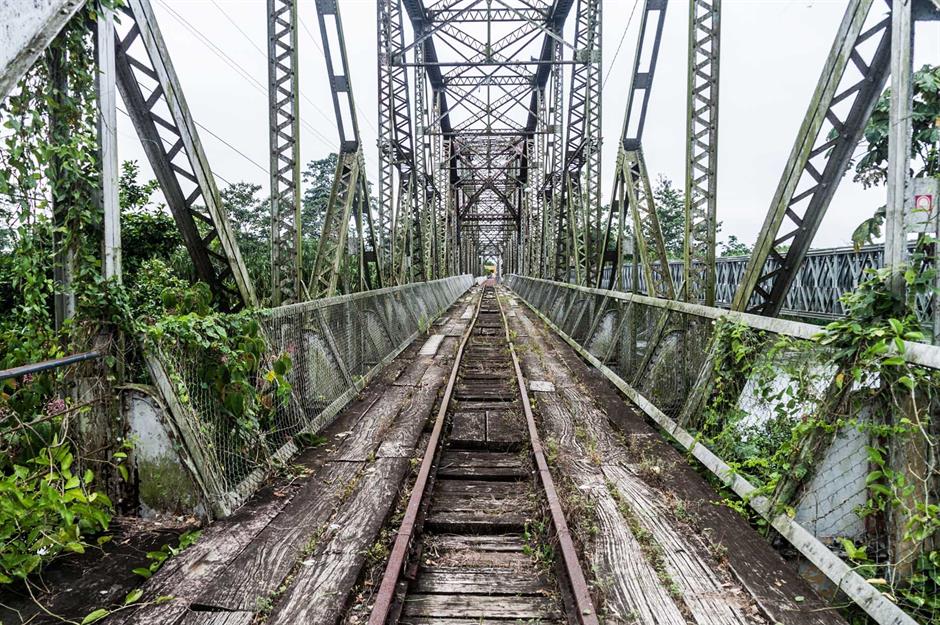
The Sixaola River forms a lush tropical border between Costa Rica and Panama, flowing from the Talamanca Mountains to the Caribbean Sea. It passes through La Amistad International Park, a UNESCO World Heritage Site shared by both countries, which is home to jaguars, pumas, ocelots and much, much more.
This historic bridge once linked Sixaola in Costa Rica and Guabito in Panama. Built over 100 years ago, it was first a railway bridge, then used by pedestrians until it finally collapsed in 2017. It was replaced in 2020 by a more modern road bridge.
Sponsored Content
Niagara Falls: Canada-USA
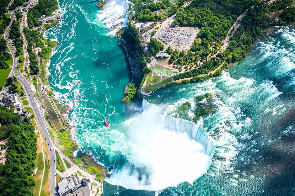
Niagara Falls straddles the border between Ontario, Canada and New York, USA, and is made up of three waterfalls: Horseshoe, American and Bridal Veil. Formed 12,000 years ago by glacial melt, it channels water from four Great Lakes into the Niagara River.
Over 700,000 gallons per second plunge over its crest, making it North America’s most powerful waterfall by volume. In 1885, it became the USA’s first state park, and in 1895, Tesla and Westinghouse built the world’s first hydroelectric plant nearby.
Limpopo River: South Africa-Zimbabwe
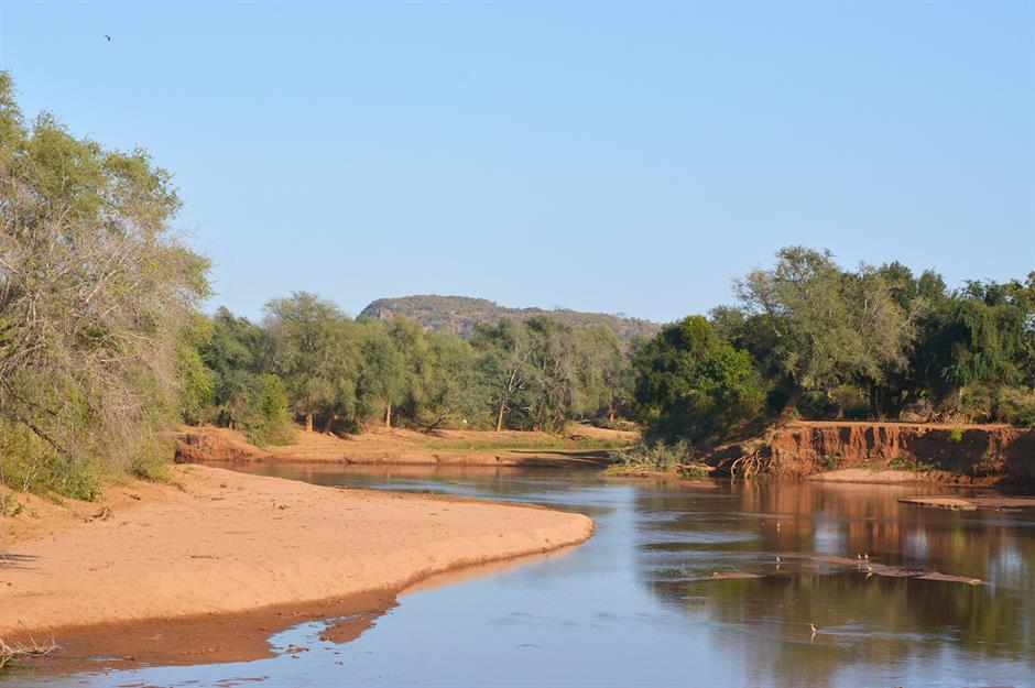
The Limpopo River flows 1,087 miles (1,750km) from the Witwatersrand mountain ridge to the Indian Ocean and forms part of the border between South Africa and Zimbabwe.
Named after the Sepedi word for 'strong gushing waterfalls', the Limpopo area is home to crocodiles, hippos, elephants, leopards and more than 750 species of birds. The Beit Bridge is this stretch of the river's busiest crossing, handling thousands of visitors daily, and is a vital trade gateway between the two countries.
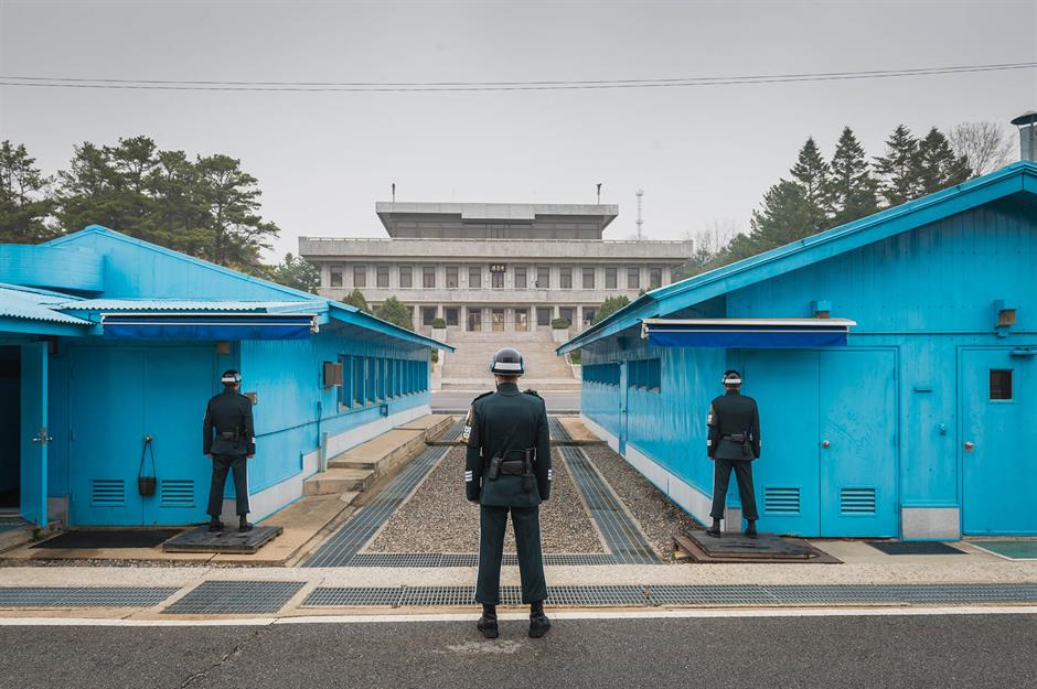
Panmunjom: South Korea-North Korea
Panmunjom – known as the 'truce village' – lies in the Demilitarised Zone (DMZ) between North and South Korea. It’s where the 1953 Korean Armistice Agreement was signed, which ended active fighting in the Korean War.
The site now hosts the Joint Security Area, with these blue conference huts straddling the border. It’s one of the few places where officials from both sides meet face-to-face. The area remains tense but important, and is often used for high-level talks and rare diplomatic gestures.
Sponsored Content
The Pyrenees mountains: France-Spain
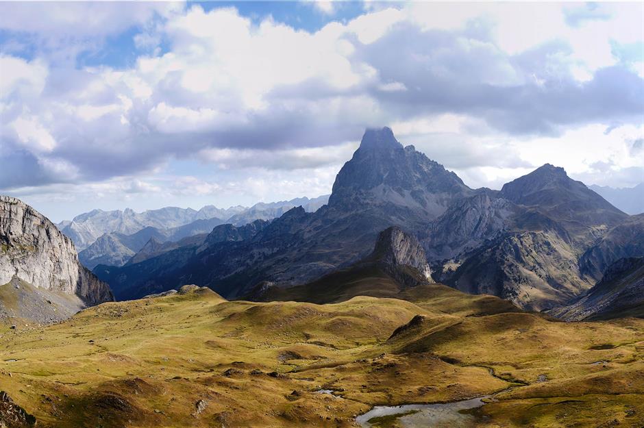
The Pyrenees mountain chain forms a natural border between France and Spain, stretching 305 miles (491km) from the Atlantic to the Mediterranean. Historically difficult to cross, the range separated the Iberian Peninsula from the rest of Europe, shaping its distinct identity.
The 1659 Treaty of the Pyrenees formalised the boundary after centuries of conflict. Today, tourists enjoy the Cirque de Gavarnie, a UNESCO-listed glacial amphitheatre; the pilgrimage town of Lourdes; and the Pic du Midi Observatory, which gives panoramic views of snow-capped peaks.
Baarle-Hertog/Baarle-Nassau: Belgium-Netherlands
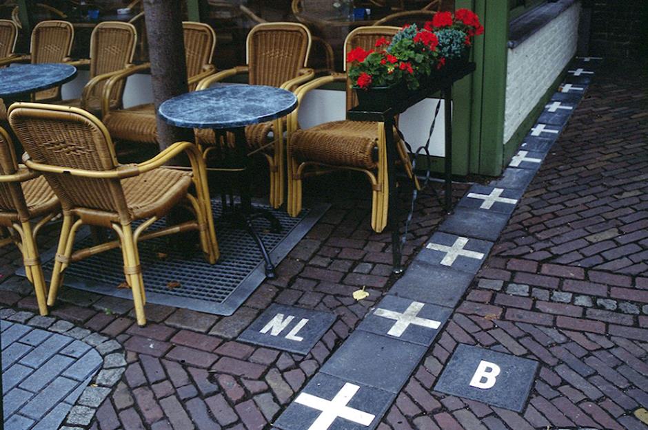
Baarle-Hertog (Belgium) and Baarle-Nassau (Netherlands) form the world’s most complex border town, with 30 enclaves. This also includes 'counter-enclaves' where Dutch territory lies inside Belgian land inside Dutch territory.
This bizarre jigsaw-like layout stems from medieval land swaps between the Dukes of Brabant and Lords of Breda, formalised in 1843. Today, some buildings – including homes – straddle both countries, with front doors determining nationality. EU integration eased daily life, but the quirky borders remain a tourist curiosity.
Pyanj River: Afghanistan-Tajikistan
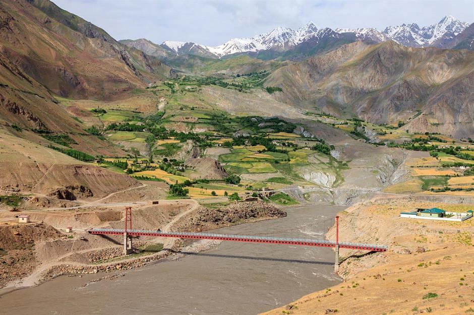
Much of the Afghanistan-Tajikistan border tracks along the Pyanj River, which is also known as Panj or Pyandzh, depending on where you are.
Stretching 700 miles (1,125km), it’s a vital artery of Central Asia and was once part of the ancient Silk Road route. Its glacial waters have supported agriculture for generations, but border tensions and Soviet-era mines affect access. The US-funded Friendship Bridge at Nizhni Pyanj is one of the border's few formal crossing points.